Western Desert (Iraq)
| Syrian Desert (بادية الشام) | |
| Badiyat al-Sham | |
| sand desert | |
|
Syrian Desert on a topographic map
|
|
| Country | Syria Iraq Jordan |
|---|---|
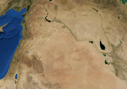
The Syrian Desert (Arabic: بادية الشام, Bâdiyat aş-Şâm), also known as the Hamad, is a combination of steppe and desert covering 500,000 square kilometers (200,000 square miles) of the Middle East, including parts of south-eastern Syria, northeastern Jordan, northern Saudi Arabia, and western Iraq. To the south it borders and merges into the Arabian Desert. The land is open, gravely desert pavement, cut with occasional wadis.
The desert is bounded by the Orontes Valley and volcanic field of Harrat al-Shamah to the west, and by the Euphrates to the east. In the north, the desert gives way to the more fertile areas of grass, and the south it runs into the deserts of the southern Arabian Peninsula.
Some sources equate the Syrian Desert with the "Hamad Desert", while others limit the name Hamad to the southern central plateau, and a few consider the Hamad to be the whole region and the Syrian Desert just the northern part.
Several parts of the Syrian Desert have been referred to separately such as the Palmyrene desert around Palmyra, and the Homs desert. The eastern section of the Syrian Desert, that within borders of Iraq, can be referred to (within Iraqi context) as the Western Desert.
The name Shamiyah has also been used for the Syrian Desert. The name has been translated in the past as Badiyat al-Sham (or Badiyat ash-Sham)
The 700-900m high region in the middle of the desert is the Hamad Plateau, a rather flat, stony semi-desert consisting of limestone bedrock covered with chert gravel. What little rain arrives on the plateau flows into local salt flats. The highest peaks of the Plateau are those of the 1000m+ Khawr um Wual in Saudi Arabia, and the 960m high Jebel Aneiza, at the border tripoint between Jordan, Iraq and Saudi Arabia.
...
Wikipedia

