West Pennant Hills
|
West Pennant Hills Sydney, New South Wales |
|||||||||||||
|---|---|---|---|---|---|---|---|---|---|---|---|---|---|

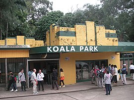
Koala Park
|
|||||||||||||
| Coordinates | 33°44′42″S 151°02′49″E / 33.74504°S 151.04697°ECoordinates: 33°44′42″S 151°02′49″E / 33.74504°S 151.04697°E | ||||||||||||
| Population | 15,967 (2011 census) | ||||||||||||
| Postcode(s) | 2125 | ||||||||||||
| Location | 25 km (16 mi) NW of Sydney CBD | ||||||||||||
| LGA(s) | |||||||||||||
| State electorate(s) |
Baulkham Hills Epping |
||||||||||||
| Federal Division(s) |
Berowra Mitchell |
||||||||||||
|
|||||||||||||
West Pennant Hills is a suburb in the Hills District of Sydney, New South Wales, Australia. West Pennant Hills is 25 kilometres north-west of the Sydney central business district in the local government areas of Hornsby Shire and The Hills Shire. Thompsons Corner is a locality in the suburb at the corner of Castle Hill and Pennant Hills Roads.
The section of the suburb within The Hills Shire council is colloquially known as West Pennant Hills Valley or The Valley.
West Pennant Hills is a residential suburb with a commercial area located at Thompsons Corner, also the site of the suburb's government primary school, West Pennant Hills Public School. The nearest train stations are Beecroft and Pennant Hills, the suburb is also serviced by buses.
To the north of West Pennant Hills near Castle Hill Road there is a small shopping complex on Coonara Avenue, where a Woolworths, newsagency, restaurants and several other small shops are located.
The IBM office located in West Pennant Hills has a regeneration plan to assist in the preservation of "nationally protected remnant ‘Sydney Blue Gum High Forest’ and Remediation and Protection ‘Sydney Turpentine Ironbark Margin Forest’ located on site"
The suburb was named for both its geological features and its man-made additions. When Sydney was first established, 'Pennant Hills', applied to the range of hills stretching north from Parramatta. The Pennant refers to a flag pole erected on the area’s highest point. During the first years of the Sydney settlement this flag pole with its pennant was a form of early communication between the government in Parramatta and the governor’s outer Sydney residence. It was used to signal to Parramatta that the governor was returning to Parramatta after spending time at his retreat in the outer areas of Sydney. When his horse-drawn carriage went past Thompsons Corner, the pennant would be raised and as this was in clear sight of the Parramatta garrison, they would prepare for his return in a few days. Local stories twist this system to say that when the pennant was raised the soldiers would have to stop drinking and clean up the streets after running amok in his absence.
...
Wikipedia

