Carlingford, New South Wales
|
Carlingford Sydney, New South Wales |
|||||||||||||
|---|---|---|---|---|---|---|---|---|---|---|---|---|---|

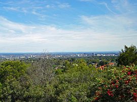
The view from Mobbs Hill has been a noted feature of the district for generations
|
|||||||||||||
| Coordinates | 33°46′37″S 151°2′53″E / 33.77694°S 151.04806°ECoordinates: 33°46′37″S 151°2′53″E / 33.77694°S 151.04806°E | ||||||||||||
| Population | 21,570 (2011 census) | ||||||||||||
| • Density | 2,730/km2 (7,070/sq mi) | ||||||||||||
| Postcode(s) | 2118 | ||||||||||||
| Area | 7.9 km2 (3.1 sq mi) | ||||||||||||
| Location | 22 km (14 mi) north-west of Sydney CBD | ||||||||||||
| LGA(s) | City of Parramatta | ||||||||||||
| State electorate(s) | |||||||||||||
| Federal Division(s) | |||||||||||||
|
|||||||||||||
Carlingford is a suburb of Sydney, in the state of New South Wales, Australia. Carlingford is 22 kilometres north-west of the Sydney central business district in the local government area of City of Parramatta. Carlingford is on the north-eastern outskirts of the Greater Western Sydney region and is on the south-eastern outskirts of the Hills District and western outskirts of Northern Suburbs.
References to Aboriginal people in the Carlingford historical record in the 18th, 19th and into the 20th century remain is limited to a handful of third party observations, reinterpreted in modern day. There are many historical ambiguities and uncertainties around clan, language and cultural groups of the area.
The people of what is now known as Carlingford at the time of the arrival of the First Fleet at Port Jackson in 1788 were the Wallumedegal or Wallumattagai people. The people were observed to live in the area bounded approximately by the Parramatta River in the south, the Lane Cove River in the east, the Parramatta area in the west and ranged north for an uncertain distance. The Wallumedegal appear to have been of the Eora language group. The clan name seems to have been derived from wallumai, the snapper fish, combined with matta, a word used in association with ‘place’ or sometimes ‘waterplace’.
Evidence of fire-stick burn off (whereby native vegetation is cleared through fire to create grasslands) along the northern banks of the Parramatta River were observed in February 1788 by an exploring boat party headed by Captain John Hunter and Lieutenant William Bradley in such places which became known as Kissing Point and Meadowbank. The grasslands created by the Aboriginals’ burn off encouraged animals to graze and enhanced the ease of hunting and gathering. Around and above these pastures backing up into the Carlingford area were thick, tall stands of Blue Gum High Forest.
...
Wikipedia

