West Ham
| West Ham | |
|---|---|
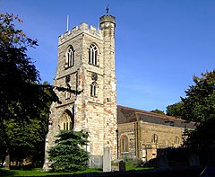
 All Saints' Parish Church, West Ham |
|
| West Ham shown within Greater London | |
| Population | 15,551 (2011 Census.Ward) |
| OS grid reference | TQ405837 |
| • Charing Cross | 6.2 mi (10.0 km) WSW |
| London borough | |
| Ceremonial county | Greater London |
| Region | |
| Country | England |
| Sovereign state | United Kingdom |
| Post town | LONDON |
| Postcode district | E13, E15 |
| Dialling code | 020 |
| Police | Metropolitan |
| Fire | London |
| Ambulance | London |
| EU Parliament | London |
| UK Parliament | |
| London Assembly | |
West Ham is in the London Borough of Newham in London, England. In the west it is a post-industrial neighbourhood abutting the site of the London Olympic Park and in the east it is mostly residential, consisting of Victorian terraced housing interspersed with higher density post-war social housing. The area has been one of the most deprived in the country and as part of the New Deal for Communities programme it forms, with neighbouring Plaistow, a regeneration area. The place lends its name to West Ham United F.C. and West Ham Church School.
A settlement in the area named Ham is first recorded as Hamme in an Anglo-Saxon charter of 958 and then in the 1086 Domesday Book as Hame. The earliest recorded use of West Ham, as distinct from East Ham, is in 1186 as Westhamma. It is formed from Old English 'hamm' and means 'a dry area of land between rivers or marshland', referring to the location of the settlement within boundaries formed by the rivers Lea, Thames and Roding and their marshes.
West Ham formed a large ancient parish of around 4,500 acres (18 km2) in the Becontree hundred of Essex. The parish was divided into three wards: Church-street, Stratford-Langthorne, and Plaistow; with the village of West Ham corresponding to the Church-street ward. The parish also included the hamlet of Upton. Following the opening of Stratford station, the first railway station in the area, in 1839, the focus of activity shifted northwards towards the fast-expanding Stratford, with the original settlement diminishing in significance. In 1840 the parish was included in the Metropolitan Police District and soon after the built-up area of London had encompassed West Ham. The parish did not form part of the statutory metropolitan area established in 1855 or the County of London established in 1889. Instead, administrative reform was undertaken in the area in much the same way as a large provincial town. A local board was formed in 1856 under the Public Health Act 1848 and subsequently the parish was incorporated as a municipal borough in 1886. In 1889 the borough was large enough in terms of population to become a county borough and was outside the area of responsibility of Essex County Council. At the time of the 1901 census it was the ninth most populous district in England with a population of 267,308. The former county borough was merged with the adjacent County Borough of East Ham to form the new London Borough of Newham on 1 April 1965.
...
Wikipedia

