County of London
| London County of London |
|
|---|---|
| County | |
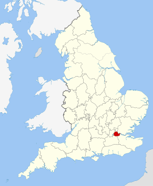
 County of London shown within England |
|
| Area | |
| • 1911 | 74,816 acres (302.77 km2) |
| • 1961 | 74,903 acres (303.12 km2) |
| Population | |
| • 1911 | 4,521,685 |
| • 1961 | 3,200,484 |
| Density | |
| • 1911 | 60/acre |
| • 1961 | 42/acre |
| History | |
| • Origin | District of the Metropolitan Board of Works |
| • Created | 1889 |
| • Abolished | 1965 |
| • Succeeded by | Greater London |
| Status | Administrative and (smaller) ceremonial county |
| Government | London County Council |
| • HQ | County Hall, Lambeth |
 Arms of London County Council |
|
| Subdivisions | |
| • Type |
Parishes and districts (1889–1900) Metropolitan boroughs (1900–1965) |
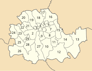
 Boroughs numbered 2-29 (1 is the City) |
|
The County of London was a county of England from 1889 to 1965, corresponding to the area known today as Inner London. It was created as part of the general introduction of elected county government in England, by way of the Local Government Act 1888. The Act created an administrative County of London, which included within its territory the City of London. However, the City of London and the County of London formed separate counties for "non-administrative" purposes. The local authority for the county was the London County Council (LCC), which initially performed only a limited range of functions, but gained further powers during its 76-year existence. The LCC provided very few services within the City of London, where the ancient Corporation monopolised local governance. In 1900 the lower-tier civil parishes and district boards were replaced with 28 new metropolitan boroughs. The territory of the county was 74,903 acres (303.12 km2) in 1961. During its existence there was a long-term decline in population as more residents moved into the outer suburbs; there were periodic reviews of the local government structures in the greater London area and several failed attempts to expand the boundaries of the county. In 1965, the London Government Act 1963 replaced the county with the much larger Greater London administrative area.
The county occupied an area of just under 75,000 acres (30,351 ha) and lay within the London Basin. It was divided into two parts (north and south) by the River Thames, which was the most significant geographic feature. It was bordered by Essex to the north-east, Kent to the south-east, Surrey the south-west and Middlesex to the north. The highest point was Hampstead Heath in the north of the county at 440 feet (134 m), which is one of the highest points in London. In 1900 a number of boundary anomalies were abolished. These included the loss of the Alexandra Park exclave to Middlesex, gaining South Hornsey in return, and the transfer of Penge to Kent.
...
Wikipedia
