West Fork River
| West Fork River | |
|
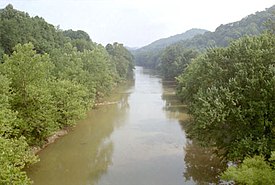
The West Fork River in Enterprise in 1996
|
|
| Country | United States |
|---|---|
| State | West Virginia |
| Counties | Upshur, Lewis, Harrison, Marion |
| Source | Confluence of Straight Fork and Whites Camp Fork |
| - location | near Rock Cave, Upshur County |
| - elevation | 1,309 ft (399 m) |
| - coordinates | 38°51′08″N 80°21′32″W / 38.85222°N 80.35889°W |
| Mouth | Monongahela River |
| - location | Fairmont |
| - elevation | 863 ft (263 m) |
| - coordinates | 39°27′53″N 80°09′11″W / 39.46472°N 80.15306°WCoordinates: 39°27′53″N 80°09′11″W / 39.46472°N 80.15306°W |
| Length | 103 mi (166 km) |
| Basin | 881 sq mi (2,282 km2) |
| Discharge | for Enterprise |
| - average | 1,160 cu ft/s (33 m3/s) (2005) |
|
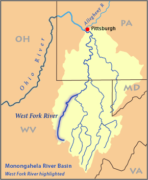
Map of the Monongahela River basin, with the West Fork River highlighted
|
|
The West Fork River is a principal tributary of the Monongahela River, 103 miles (166 km) long, in north-central West Virginia in the United States. Via the Monongahela and Ohio Rivers, it is part of the watershed of the Mississippi River, draining an area of 881 square miles (2,284 km²) on the unglaciated portion of the Allegheny Plateau.
The river is formed near the community of Rock Cave in southwestern Upshur County by the confluence of small headwaters tributaries known as Straight Fork and Whites Camp Fork. From this confluence the West Fork River flows north through Lewis, Harrison and Marion Counties, through the communities of Weston, West Milford, Clarksburg, Lumberport, Shinnston, Enterprise, Worthington, and Monongah to Fairmont, where it joins the Tygart Valley River from the west to form the Monongahela River. Among other tributaries, it collects Stonecoal Creek in Weston; Hackers Creek in southern Harrison County; Elk Creek in Clarksburg; and Simpson Creek and Tenmile Creek in northern Harrison County.
...
Wikipedia


