Wentwood
| Wentwood | |
|---|---|

Wentwood reservoir and hills seen from Gray Hill
|
|
| Highest point | |
| Elevation | 309 m (1,014 ft) |
| Prominence | 243 m (797 ft) |
| Listing | Marilyn, council top (Newport) |
| Geography | |
| Location | Newport / Monmouthshire, Wales, United Kingdom |
| OS grid | ST411942 |
Wentwood Village
|
|
|---|---|
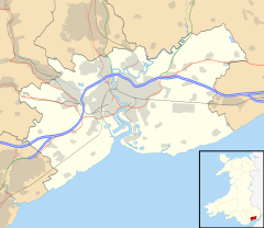
| Wentwood Village shown within Newport | |
| Principal area | |
| Country | Wales |
| Sovereign state | United Kingdom |
| Post town | NEWPORT |
| Postcode district | NP18 2 |
| Dialling code | 01633 Llanwern and Penhow exchanges |
| Police | Gwent |
| Fire | South Wales |
| Ambulance | Welsh |
| EU Parliament | Wales |
| UK Parliament | |
Wentwood (Welsh: Coed Gwent) is a forested area of hills, rising to 309 metres (1,014 ft), in Monmouthshire, South Wales. It is located to the north east of, and partly within the boundaries of, the city of Newport.
Wentwood is underlain by sandstones which are assigned to the Brownstones Formation of the Old Red Sandstone, a suite of sedimentary rocks laid down during the Devonian period. The beds dip gently to moderately in a south-easterly direction. It is the southernmost part of a range of hills formed by the relatively hard-wearing Brownstones sandstones which stretch in a rough arc northwards through eastern Monmouthshire, the broadly west-facing scarps of which are generally well wooded.
There is a small area of houses in Wentwood that are known as Wentwood Hamlet. There is also a church in Wentwood called Gilgal Chapel.
It is the largest ancient woodland in Wales and the ninth largest in the UK. The current wooded area is a remnant of a much larger ancient forest which once extended between the rivers Usk and Wye and which divided the old kingdom of Gwent into two - Gwent Uwchcoed and Iscoed, that is, above and below the wood.
The area contains bronze age burial mounds, a stone circle, and a Megalithic alignment on Gray Hill, Monmouthshire.
...
Wikipedia

