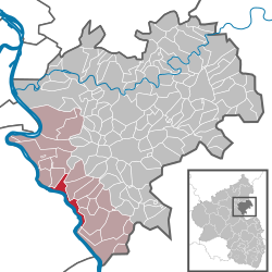
Wellmich
| Sankt Goarshausen | ||
|---|---|---|
 |
||
|
||
| Coordinates: 50°9′17″N 7°42′55″E / 50.15472°N 7.71528°ECoordinates: 50°9′17″N 7°42′55″E / 50.15472°N 7.71528°E | ||
| Country | Germany | |
| State | Rhineland-Palatinate | |
| District | Rhein-Lahn-Kreis | |
| Municipal assoc. | Loreley | |
| Government | ||
| • Mayor | Bernhard Roth (CDU) | |
| Area | ||
| • Total | 7.00 km2 (2.70 sq mi) | |
| Population (2015-12-31) | ||
| • Total | 1,317 | |
| • Density | 190/km2 (490/sq mi) | |
| Time zone | CET/CEST (UTC+1/+2) | |
| Postal codes | 56346 | |
| Dialling codes | 06771 | |
| Vehicle registration | EMS, DIZ, GOH | |
| Website | www.sankt-goarshausen.de | |
Sankt Goarshausen (abbreviated St. Goarshausen) is a town located in the Rhein-Lahn-Kreis in Nassau on the eastern shore of the Rhine, in the section known as the Rhine Gorge, directly across the river from Sankt Goar, in the German state Rhineland-Palatinate. It is located within the Nassau Nature Park and the Rhine Gorge UNESCO world heritage site, and was historically part of the Duchy of Nassau. It lies approximately 30 km south of Koblenz, and it is above all famous for the Lorelei rock nearby. Sankt Goarshausen is the seat of the Loreley collective municipality. The town's economy is based on wine making and tourism.
The Sankt Goarshausen railway station connects the town with Wiesbaden, Frankfurt and Koblenz. Sankt Goarshausen was formerly the terminus of the Nassau Light Railway line between Sankt Goarshausen and Nastätten.
In 1885, St. Goarshausen had almost 1,456 inhabitants. Close to the town in the hillside just above it, lie the ruins of 14th century Castle Katz, ruined since 1806.
Around 50% of the population are Protestants, while around 30% are Catholics. Sankt Goarshausen had a small Jewish community from the 17th century to the 1930s, peaking at 2,4% in 1895.
The town has 1,585 inhabitants as of[update] December 31, 2002, and is the seat of the township association (Verbandsgemeinde) Loreley. With the villages Ehrental, Wellmich and Heide, the number of inhabitants is over 2,000.
...
Wikipedia


