Sankt Goar
| Sankt Goar | ||
|---|---|---|

View of St. Goar (in top half of picture) from Patersberg
|
||
|
||
| Coordinates: 50°9′N 7°43′E / 50.150°N 7.717°ECoordinates: 50°9′N 7°43′E / 50.150°N 7.717°E | ||
| Country | Germany | |
| State | Rhineland-Palatinate | |
| District | Rhein-Hunsrück-Kreis | |
| Municipal assoc. | Sankt Goar-Oberwesel | |
| Government | ||
| • Mayor | Horst Vogt (CDU) | |
| Area | ||
| • Total | 22.93 km2 (8.85 sq mi) | |
| Elevation | 74 m (243 ft) | |
| Population (2015-12-31) | ||
| • Total | 2,704 | |
| • Density | 120/km2 (310/sq mi) | |
| Time zone | CET/CEST (UTC+1/+2) | |
| Postal codes | 56329 | |
| Dialling codes | 06741 | |
| Vehicle registration | SIM, GOA | |
| Website | www |
|
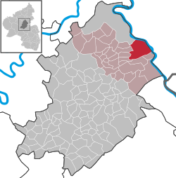
Sankt Goar is a town on the west bank of the Middle Rhine in the Rhein-Hunsrück-Kreis (district) in Rhineland-Palatinate, Germany. It belongs to the Verbandsgemeinde of Sankt Goar-Oberwesel, whose seat is in the town of Oberwesel.
Sankt Goar is well known for its central location in the Rhine Gorge, a UNESCO World Heritage Site since July 2002. Above the town stand the ruins of Burg Rheinfels, one of the castles for which the Middle Rhine is famous, and across the river lies the sister town of Sankt Goarshausen with its own castles, Katz and Maus (“Cat” and “Mouse”). The famous Lorelei rock is close-by, slightly upstream on the opposite bank.
Sankt Goar lies in the Rhine Gorge and the narrow canal on the Rhine that flows through the Rhein Massive. This part of the gorge on the left bank borders on the edge of the Rhein - Hunsrück, on the right bank it Borders on the Banks of the Taunus. The characteristic narrow-valley form came into use through downcutting in a massive that was undergoing an uplift.
The nearest major Towns are the city of Koblenz, some 24 km to the north, and the town of Bingen am Rhein, some 25 km to the southeast, in both cases as the crow flies. Sankt Goar is linked by the Loreley Ferry with its sister town of Sankt Goarshausen directly across the Rhine. The Rhine’s width here is roughly 250 m.
...
Wikipedia


