Welchweiler
| Welchweiler | ||
|---|---|---|
|
||
| Coordinates: 49°34′37″N 7°30′23″E / 49.57694°N 7.50639°ECoordinates: 49°34′37″N 7°30′23″E / 49.57694°N 7.50639°E | ||
| Country | Germany | |
| State | Rhineland-Palatinate | |
| District | Kusel | |
| Municipal assoc. | Altenglan | |
| Government | ||
| • Mayor | Horst Christoffel | |
| Area | ||
| • Total | 3.48 km2 (1.34 sq mi) | |
| Elevation | 250 m (820 ft) | |
| Population (2015-12-31) | ||
| • Total | 199 | |
| • Density | 57/km2 (150/sq mi) | |
| Time zone | CET/CEST (UTC+1/+2) | |
| Postal codes | 66887 | |
| Dialling codes | 06387 | |
| Vehicle registration | KUS | |
| Website | www.welchweiler.com | |
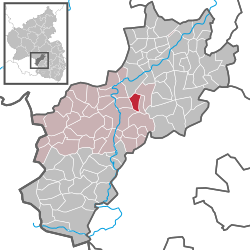
Welchweiler is an Ortsgemeinde – a municipality belonging to a Verbandsgemeinde, a kind of collective municipality – in the Kusel district in Rhineland-Palatinate, Germany. It belongs to the Verbandsgemeinde of Altenglan, whose seat is in the like-named municipality.
The municipality lies on the west side of the 536-metre-high Herrmannsberg in the Western Palatinate. The village’s elevation is some 300 m above sea level and it lies on a small stream called the Welchbach, which runs down into the Sachsbach. From the foot of the Herrmannsberg, Welchweiler is split by a narrow ridge and the valley of the Sachsbach. The Sachsbach empties into the river Glan and is known in its lower reaches as the Horschbach. Welchweiler lies only a few hundred metres from the village of Elzweiler, which itself lies in the valley of the Sachsbach. Welchweiler’s municipal area measures 348 ha, of which 5 ha is wooded.
Welchweiler borders in the north on the municipality of Horschbach, in the east on the municipality of Elzweiler, in the south on the municipality of Altenglan, in the southwest on the municipality of Bedesbach and in the northwest on the municipality of Sankt Julian. Welchweiler also meets the municipalities of Ulmet and Bosenbach at single points in the west and southeast respectively.
Most of Welchweiler’s houses stand alongside the Kreisstraße that runs from Glanbrücken to Altenglan on small village streets. The village expanded only slightly in the 19th century, and there was likewise not a great deal of growth after the Second World War. Most houses are farmhouses of the Einfirsthaus type (“one-roof-ridge house”), and there are also smaller workers’ houses.
...
Wikipedia


