Weber City, Virginia
| Weber City, Virginia | |
|---|---|
| Town | |
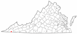
 Location of Weber City, Virginia |
|
| Coordinates: 36°37′24″N 82°33′40″W / 36.62333°N 82.56111°WCoordinates: 36°37′24″N 82°33′40″W / 36.62333°N 82.56111°W | |
| Country | United States |
| State | Virginia |
| County | Scott |
| Area | |
| • Total | 1.1 sq mi (2.9 km2) |
| • Land | 1.1 sq mi (2.9 km2) |
| • Water | 0.0 sq mi (0.0 km2) |
| Elevation | 1,306 ft (398 m) |
| Population (2010) | |
| • Total | 1,327 |
| • Density | 1,200/sq mi (460/km2) |
| Time zone | Eastern (EST) (UTC-5) |
| • Summer (DST) | EDT (UTC-4) |
| ZIP code | 24290 |
| Area code(s) | 276 |
| FIPS code | 51-83808 |
| GNIS feature ID | 1476430 |
Weber City is an incorporated town in Scott County, Virginia, United States. The population was 1,327 at the 2010 census. It is part of the Kingsport–Bristol (TN)–Bristol (VA) Metropolitan Statistical Area, which is a component of the Johnson City–Kingsport–Bristol, TN-VA Combined Statistical Area – commonly known as the "Tri-Cities" region.
Weber City is unique in how it received its name. There were no "Webers" living in the area of Weber City. The area was known as "Moccasin Gap" after the local gap that U.S. 23 runs through. Local businessman Frank Parker Sr. heard the future name on the Amos 'n' Andy radio show during a skit involving the upscale real estate development of Weber City. As a joke, Parker erected a sign outside his service station on U.S. 23 that read "Welcome to Weber City". However, when the town was incorporated in 1954, the area had become known locally as "Weber City" and, as such, the name was chosen for the new town. Weber City is one of very few towns that received its name from a radio program.
Weber City is located at 36°37′24″N 82°33′40″W / 36.62333°N 82.56111°W (36.623284, -82.561039).
...
Wikipedia
