Waukon, Iowa
| Waukon, Iowa | |
|---|---|
| City | |
 Location of Waukon within County and State |
|
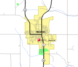
 Detailed local map of Waukon |
|
| Coordinates: 43°16′8″N 91°28′45″W / 43.26889°N 91.47917°WCoordinates: 43°16′8″N 91°28′45″W / 43.26889°N 91.47917°W | |
| Country |
|
| State |
|
| County | Allamakee |
| Township | Makee |
| Area | |
| • Total | 2.82 sq mi (7.30 km2) |
| • Land | 2.82 sq mi (7.30 km2) |
| • Water | 0 sq mi (0 km2) |
| Elevation | 1,237 ft (377 m) |
| Population (2010) | |
| • Total | 3,897 |
| • Estimate (2012) | 3,871 |
| • Density | 1,381.9/sq mi (533.6/km2) |
| Time zone | Central (CST) (UTC-6) |
| • Summer (DST) | CDT (UTC-5) |
| ZIP code | 52172 |
| Area code(s) | 563 |
| FIPS code | 19-82740 |
| GNIS feature ID | 0462754 |
| Website | cityofwaukon.com |
Waukon is a city in Makee Township, Allamakee County, Iowa, United States, and the county seat of Allamakee County. The population was 3,897 at the 2010 census. It is home to the annual Allamakee County Fair.
Waukon is often said to be named for Waukon Decorah, a Ho Chunk (Winnebago) leader who was a U.S. ally during the 1832 Black Hawk War, although the city is also said to be named for his son Chief John Waukon. Winnebagos lived in this area of Iowa in the 1840s, before being forced to relocate to Minnesota.
The first white settler arrived in 1849, and the town was founded and the Waukon Post Office opened in 1853. A court house was completed in 1861, and the county seat was moved to Waukon in 1867 after 8 elections attempting to decide the location of the county seat. The town was incorporated in 1883.
Waukon is only about 16 miles from Waukon Junction, on the Mississippi River, but the rail line between these two points was 33 miles long, climbing 600 feet through some of the roughest terrain in Iowa. The Waukon and Mississippi Railroad, which opened in 1877, was originally built as a narrow gauge line. The line was originally controlled by the Chicago and Northwestern but was quickly acquired by the Chicago, Milwaukee and St. Paul Railway. The line was widened to standard gauge after purchase by the Milwaukee Road. Its only marginal traffic through its existence led to the road's abandonment in the late 1960s.
There is a deposit of limonite (Iron Ore) about 3 miles northeast of Waukon called Iron Hill, holding an estimated 10 million tons of ore. This is the highest point in northeastern Iowa. the Waukon Iron Company began developing an open-pit mine and ore-washing plant on this site in 1899, with a capacity of 300 tons per 10-hour shift. Production was seriously limited by the need to haul the ore 3 miles to the railroad, and the mine was, ultimately, a failure.
...
Wikipedia
