Allamakee County, Iowa
| Allamakee County, Iowa | |
|---|---|

|
|
 Location in the U.S. state of Iowa |
|
 Iowa's location in the U.S. |
|
| Founded | 1847 |
| Seat | Waukon |
| Largest city | Waukon |
| Area | |
| • Total | 659 sq mi (1,707 km2) |
| • Land | 639 sq mi (1,655 km2) |
| • Water | 20 sq mi (52 km2), 3.0% |
| Population | |
| • (2010) | 14,330 |
| • Density | 22/sq mi (8/km²) |
| Congressional district | 1st |
| Time zone | Central: UTC-6/-5 |
| Website | www |
Allamakee County (pronounced AL-uh-muh-KEY) is the northeastern-most county in the U.S. state of Iowa. As of the 2010 census, the population was 14,330. Its county seat is Waukon.
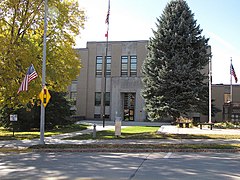
Allamakee County was formed on February 20, 1847. The derivation of the name is debated, some believing it was the name of an Indian chief, others think it was named for Allen Magee, an early historic trader. The first Allamakee County Courthouse in Waukon, built in 1861, now serves as the Allamakee County Historical Museum. The present Allamakee County Court House was built in 1940. Both courthouse buildings are listed on the National Register of Historic Places.
According to the U.S. Census Bureau, the county has a total area of 659 square miles (1,710 km2), of which 639 square miles (1,660 km2) is land and 20 square miles (52 km2) (3.0%) is water.
In the northern part of the county is the Upper Iowa River. In the southern part is the Yellow River. The eastern boundary is the Mississippi River. All offer scenic and recreational opportunities, particularly in Yellow River State Forest.
French Creek flows north of Waukon, outside the city limits. Paint Creek, named after Paint Rock Bluff, flows out of the south of Waukon. Norfolk creek originates in the western outskirts of Waukon and is effluent to the Yellow River. Clear Creek flows into Lansing. Village Creek flows through essentially rural terrain. All are tributary to the Mississippi River.
...
Wikipedia
