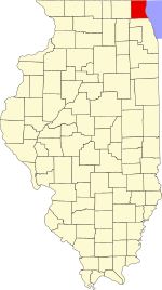
Wauconda Township, Lake County, Illinois
| Wauconda Township | |
|---|---|
| Township | |
 Location in Lake County |
|
 Lake County's location in Illinois |
|
| Coordinates: 42°17′02″N 88°09′19″W / 42.28389°N 88.15528°WCoordinates: 42°17′02″N 88°09′19″W / 42.28389°N 88.15528°W | |
| Country | United States |
| State | Illinois |
| County | Lake |
| Established | November 6, 1849 |
| Government | |
| • Supervisor | Glenn L. Swanson |
| Area | |
| • Total | 24.2 sq mi (62.8 km2) |
| • Land | 22.9 sq mi (59.3 km2) |
| • Water | 1.4 sq mi (3.5 km2) |
| Elevation | 797 ft (243 m) |
| Population (2010) | |
| • Total | 21,730 |
| • Density | 900/sq mi (350/km2) |
| Time zone | CST (UTC-6) |
| • Summer (DST) | CDT (UTC-5) |
| GNIS feature ID | 0429902 |
| Website | www |
Wauconda Township is a township in Lake County, Illinois, USA. As of the 2010 census, its population was 21,730.
Wauconda Township covers an area of 24.2 square miles (62.8 km2); of this, 1.4 square miles (3.5 km2) or 5.59 percent is water. Lakes in this township include Bangs Lake and Slocum Lake. The stream of Mutton Creek runs through this township.
The township contains four cemeteries: Fisher Family, Saint Peters, Volo and Wauconda.
...
Wikipedia
