Watertown, Connecticut
| Watertown, Connecticut | ||
|---|---|---|
| Town | ||
|
||
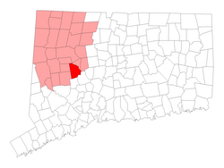
 Location in Litchfield County, Connecticut |
||
| Coordinates: 41°37′N 73°7′W / 41.617°N 73.117°WCoordinates: 41°37′N 73°7′W / 41.617°N 73.117°W | ||
| Country | United States | |
| State | Connecticut | |
| NECTA | Waterbury | |
| Region | Central Naugatuck Valley | |
| Incorporated | 1780 | |
| Government | ||
| • Type | Council-manager | |
| • Town manager | Robert Scannell | |
| • Town council | Raymond F. Primini, Chm.(R) Mary Ann Rosa, Vice Chm. (R) Gary L. Bernier David J. Demirs (D) Richard DiFederico (R) Ed Lopes (R) Joe Polletta (R) Lou Razza (D) K. Duplisse (R) |
|
| • Board of Education Commissioners | Leslie Crotty, Chm. (R) Tom Lambert, Vice Chm. (R) Janelle Wilk, Sec. (R) Robert Makowski (R) Victor Vicenzi, Jr. (R) Cathie Rinaldi (R) Josephine Cavallo-Rosa (D) James C. Gambardella (D) Cheryl Albino (D) |
|
| Area | ||
| • Total | 29.6 sq mi (76.7 km2) | |
| • Land | 29.2 sq mi (75.5 km2) | |
| • Water | 0.4 sq mi (1.1 km2) | |
| Elevation | 620 ft (189 m) | |
| Population (2010) | ||
| • Total | 22,514 | |
| • Density | 765/sq mi (298.2/km2) | |
| Time zone | Eastern (UTC-5) | |
| • Summer (DST) | Eastern (UTC-4) | |
| ZIP code | 06779, 06795 | |
| Area code(s) | 860 | |
| FIPS code | 09-80490 | |
| GNIS feature ID | 0213527 | |
| Website | www |
|
Watertown is a town in Litchfield County, Connecticut, United States. The population was 22,514 at the 2010 census. The zip code for Watertown is 06795. It is a suburb of Waterbury. It borders the towns of Woodbury, Middlebury, Litchfield, Plymouth, Bethlehem, and Thomaston.
More than 310 years ago the area that is now Watertown belonged to the local Paugasuck Indians. But in 1684, Thomas Judd and 35 other proprietors bought the land from the Indians and town history began.
It is in the Eastern Standard time zone. Elevation is 620 feet.
According to the United States Census Bureau, the town has a total area of 29.6 square miles (76.6 km²), of which, 29.1 square miles (75.5 km²) of it is land and 0.4 square miles (1.1 km²) of it (1.45%) is water. Watertown also includes the section known as Oakville, which is often mistaken for a separate town. Although Oakville has its own post office and ZIP code, it does not have a charter or town government of its own. Oakville also receives all of its city services (Police, fire, water and so on) from Watertown.
As of the census of 2000, there were 21,661 people, 8,046 households, and 5,994 families residing in the town. The population density was 743.0 people per square mile (286.9/km²). There were 8,298 housing units at an average density of 284.6 per square mile (109.9/km²). The racial makeup of the town was 96.46% White, 0.75% African American, 0.12% Native American, 1.27% Asian, 0.05% Pacific Islander, 0.48% from other races, and 0.87% from two or more races. Hispanic or Latino of any race were 1.87% of the population.
...
Wikipedia

