Bethlehem, Connecticut
| Bethlehem, Connecticut | ||
|---|---|---|
| Town | ||
|
||
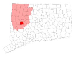
 Location in Litchfield County, Connecticut |
||
| Coordinates: 41°38′21″N 73°12′31″W / 41.63917°N 73.20861°WCoordinates: 41°38′21″N 73°12′31″W / 41.63917°N 73.20861°W | ||
| Country | United States | |
| State | Connecticut | |
| NECTA | Waterbury, CT | |
| Region | Central Naugatuck Valley | |
| Incorporated | 1787 | |
| Government | ||
| • Type | Selectman-town meeting | |
| • First selectman | Leonard Assard (D) | |
| • Selectman | David W. Deaken, Jr. (D) | |
| • Selectman | David C. Butkus, Jr. (R) | |
| Area | ||
| • Total | 19.7 sq mi (51.0 km2) | |
| • Land | 19.4 sq mi (50.1 km2) | |
| • Water | 0.3 sq mi (0.8 km2) | |
| Elevation | 860 ft (262 m) | |
| Population (2005) | ||
| • Total | 3,596 | |
| • Density | 185/sq mi (72/km2) | |
| Time zone | Eastern (UTC-5) | |
| • Summer (DST) | Eastern (UTC-4) | |
| ZIP code | 06751 | |
| Area code(s) | 203 | |
| FIPS code | 09-04930 | |
| GNIS feature ID | 0213391 | |
| Website | www |
|
Bethlehem is a town in Litchfield County, Connecticut, United States. The population was 3,422 at the 2000 census. The town center was designated in the 2000 census as a census-designated place (CDP).
The town's name has prompted thousands of visitors each December to mail their Christmas cards at the local post office in order to get a "Bethlehem" postmark. The post office also has nearly 100 Christmas-related stamps for customers to decorate their envelopes during the holiday season.
Bethlehem is one of the two towns in Litchfield County served by the area code 203/area code 475 overlay. The other is the Town of Woodbury.
According to the United States Census Bureau, the town has a total area of 19.7 square miles (51 km2), of which 19.4 square miles (50 km2) is land and 0.3 square miles (0.78 km2) (1.53%) is water. The census-designated place (CDP) corresponding to the town center has a total area of 8.1 square miles (21 km2), of which 7.8 square miles (20 km2) is land and 0.3 square miles (0.78 km2) (3.35%) is water.
At the eastern side of town is a ridge called "the Devil's Backbone", one of more than 30 Connecticut places named after the devil.
At the 2010 census Bethlehem had a population of 3,607. The racial composition of the population was 97.9% white, 0.4% black or African American, 0.1% Native American, 0.5% Asian, 0.2% from some other race and 0.9% from two or more races. 1.7% of the population were Hispanic or Latino of any race.
At the 2000 census, there were 3,422 people, 1,246 households and 935 families residing in the town. The population density was 176.8 per square mile (68.2/km²). There were 1,388 housing units at an average density of 71.7 per square mile (27.7/km²). The racial makeup of the town was 97.49% White, 0.26% African American, 0.06% Native American, 0.79% Asian, 0.03% Pacific Islander, 0.38% from other races and 0.99% from two or more races. Hispanic or Latino of any race were 0.64% of the population.
...
Wikipedia

