Washita County, Oklahoma
| Washita County, Oklahoma | |
|---|---|

The Washita County Courthouse in 2015.
|
|
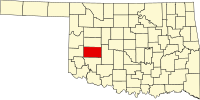
 Location in the U.S. state of Oklahoma |
|
 Oklahoma's location in the U.S. |
|
| Founded | 1891 |
| Seat | New Cordell |
| Largest city | New Cordell |
| Area | |
| • Total | 1,009 sq mi (2,613 km2) |
| • Land | 1,003 sq mi (2,598 km2) |
| • Water | 5.6 sq mi (15 km2), 0.6% |
| Population (est.) | |
| • (2013) | 11,678 |
| • Density | 12/sq mi (5/km²) |
| Congressional district | 3rd |
| Time zone | Central: UTC-6/-5 |
Washita County is a county located in the U.S. state of Oklahoma. As of the 2010 census, the population was 11,629. Its county seat is New Cordell. The county seat was formerly located in Cloud Chief. The county was created in 1891.
In 1883, John Miles leased 3,000,000 acres (12,000 km2) of Cheyenne and Arapaho land to seven cattlemen. However, arguments soon developed between the cattlemen and the tribesmen. In 1885, the Federal government terminated all of the leases and ordered the cattlemen to remove their stock.
The area was settled in 1886, when John Seger established a colony along Cobb Creek. Seger convinced 120 Cheyenne and Arapaho to settle near the old ranch headquarters at Cobb Creek. The intent was that "Seger's Colony" would teach these tribes how to farm, using modern agricultural methods. The name, Seger's Colony, would be shortened and become the present day town of Colony, Oklahoma.
After the government declared the excess lands of the Cheyenne and Arapaho Indian Reservation available for non-Indian settlement, the Cheyenne-Arapaho Opening was made available to homesteading on April 19, 1892, in the Land Run of 1892. At that time, the town of Tacola, soon renamed as Cloud Chief, was designated by the Secretary of the Interior as the county seat.
Washita County is located in that part of western Oklahoma which was included in County H of the Territory of Oklahoma, an organized incorporated territory of the United States that existed from 2 May 1890, until 16 November 1907, when it was joined with the Indian territory and admitted to the Union as the State of Oklahoma. The county itself was renamed for the Washita River. The French had called the river "Faux Ouachita," literally meaning "false Washita," to distinguish it from the ‘true’ Ouachita in Arkansas and Louisiana. The spelling of the name of the Oklahoma Washita was changed by substituting "w" for "ou."
...
Wikipedia
