Wall, South Dakota
|
Wall, South Dakota Makȟóšiča Aglágla Otȟuŋwahe |
|
|---|---|
| Town | |

Wall Drug Store
|
|
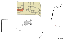
 Location in Pennington County and the state of South Dakota |
|
| Coordinates: 43°59′30″N 102°14′27″W / 43.99167°N 102.24083°WCoordinates: 43°59′30″N 102°14′27″W / 43.99167°N 102.24083°W | |
| Country | United States |
| State | South Dakota |
| County | Pennington |
| Incorporated | 1908 |
| Area | |
| • Total | 2.22 sq mi (5.75 km2) |
| • Land | 2.17 sq mi (5.62 km2) |
| • Water | 0.05 sq mi (0.13 km2) |
| Elevation | 2,825 ft (861 m) |
| Population (2010) | |
| • Total | 766 |
| • Estimate (2015) | 877 |
| • Density | 353.0/sq mi (136.3/km2) |
| Time zone | Mountain (MST) (UTC-7) |
| • Summer (DST) | MDT (UTC-6) |
| ZIP code | 57790 |
| Area code(s) | 605 |
| FIPS code | 46-68380 |
| GNIS feature ID | 1262653 |
| Website | Wall, South Dakota |
Wall (Lakota: Makȟóšiča Aglágla Otȟuŋwahe, "Town alongside the Badlands") is a town in Pennington County, South Dakota, United States. The population was 766 at the 2010 census.
Wall was platted in 1907 when the Chicago and North Western Railroad was extended to that point. The town was incorporated in 1908. Wall was named from the nearby steep Badlands.
The town is most famous for the Wall Drug Store, which opened as a small pharmacy in 1931 during the Depression, but eventually developed into a large roadside tourist attraction.
The National Grasslands Visitor Center is located in Wall.
Wall is located at 43°59′30″N 102°14′27″W / 43.99167°N 102.24083°W (43.991559, -102.240956).
According to the United States Census Bureau, the town has a total area of 2.22 square miles (5.75 km2), of which, 2.17 square miles (5.62 km2) of it is land and 0.05 square miles (0.13 km2) is water.
Wall has been assigned the ZIP code 57790 and the FIPS place code 68380.
...
Wikipedia
