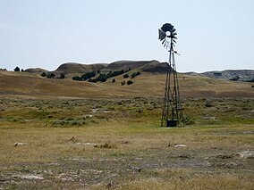
Buffalo Gap National Grassland
| Buffalo Gap National Grassland | |
|---|---|
|
IUCN category VI (protected area with sustainable use of natural resources)
|
|
 |
|
| Location | South Dakota, United States |
| Nearest city | Hot Springs, SD |
| Coordinates | 43°29′57″N 102°53′21″W / 43.49917°N 102.88917°WCoordinates: 43°29′57″N 102°53′21″W / 43.49917°N 102.88917°W |
| Area | 595,715 acres (2,410.77 km2) |
| Established | June 23, 1960 |
| Governing body | U.S. Forest Service |
| Website | Buffalo Gap National Grassland |
Buffalo Gap National Grassland is a National Grassland located primarily in southwestern South Dakota, United States. It is also the second largest National Grassland, after Little Missouri National Grassland in North Dakota. Characteristics of the grasslands include mixed prairie and chalky badlands. The grassland is managed by the U.S. Forest Service and is a division of Nebraska National Forest. In descending order of land area it is located in parts of Fall River, Pennington, Jackson, and Custer counties.
Buffalo Gap National Grassland is managed by the Forest Service together with the Nebraska and Samuel R. McKelvie National Forests and the Fort Pierre and Oglala National Grasslands from common offices in Chadron, Nebraska. There are local ranger district offices located in Hot Springs and Wall. It also surrounds Badlands National Park and Minuteman Missile National Historic Site.
...
Wikipedia


