Wageningen, The Netherlands
| Wageningen | |||
|---|---|---|---|
| Municipality | |||
 |
|||
|
|||
| Motto(s): City of Life Sciences | |||
 Location in Gelderland |
|||
| Coordinates: 51°58′N 5°40′E / 51.967°N 5.667°ECoordinates: 51°58′N 5°40′E / 51.967°N 5.667°E | |||
| Country | Netherlands | ||
| Province | Gelderland | ||
| City right | 12 June 1263 | ||
| Government | |||
| • Body | Municipal council | ||
| • Mayor | Geert van Rumund (PvdA) | ||
| Area | |||
| • Total | 32.36 km2 (12.49 sq mi) | ||
| • Land | 30.49 km2 (11.77 sq mi) | ||
| • Water | 1.87 km2 (0.72 sq mi) | ||
| Elevation | 9 m (30 ft) | ||
| Population (August 2017) | |||
| • Total | 38,405 | ||
| • Density | 1,260/km2 (3,300/sq mi) | ||
| Demonym(s) | Wageninger | ||
| Time zone | CET (UTC+1) | ||
| • Summer (DST) | CEST (UTC+2) | ||
| Postcode | 6700–6709 | ||
| Area code | 0317 | ||
| Website | www |
||
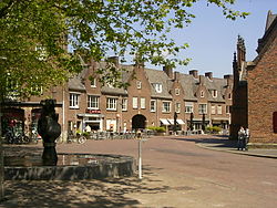
Wageningen (Dutch pronunciation: [ˈʋaːɣənɪŋə(n)] (![]() listen)) is a municipality and a historic town in the central Netherlands, in the province of Gelderland. It is famous for Wageningen University, which specialises in life sciences. The municipality had a population of 38,405 in 2017, of which many thousands are students from over 150 countries.
listen)) is a municipality and a historic town in the central Netherlands, in the province of Gelderland. It is famous for Wageningen University, which specialises in life sciences. The municipality had a population of 38,405 in 2017, of which many thousands are students from over 150 countries.
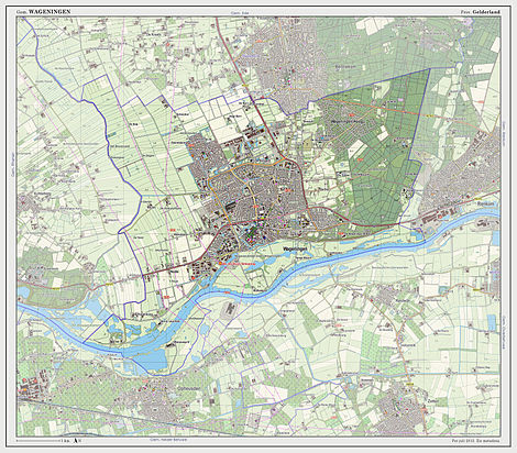
Wageningen is situated on the north bank of the Nederrijn (the Dutch portion of the Lower Rhine) part of the Gelderse valley (Dutch: Gelderse Vallei) and the Veluwe, of which the southwest hill is called the Wageningse Berg. Wageningen can be reached by car from highways A12 via the N781, A15 via the N233 and N225, and A50 via the N225, and from the Ede-Wageningen railway station via a 20-minute bus drive to the Wageningen central terminal (see below).,
...
Wikipedia


