Wageningen
| Wageningen | |||
|---|---|---|---|
| Municipality | |||
 |
|||
|
|||
| Motto: City of Life Sciences | |||
 Location in Gelderland |
|||
| Coordinates: 51°58′N 5°40′E / 51.967°N 5.667°ECoordinates: 51°58′N 5°40′E / 51.967°N 5.667°E | |||
| Country | Netherlands | ||
| Province | Gelderland | ||
| City right | 12 June 1263 | ||
| Government | |||
| • Body | Municipal council | ||
| • Mayor | Geert van Rumund (PvdA) | ||
| Area | |||
| • Total | 32.36 km2 (12.49 sq mi) | ||
| • Land | 30.49 km2 (11.77 sq mi) | ||
| • Water | 1.87 km2 (0.72 sq mi) | ||
| Elevation | 9 m (30 ft) | ||
| Population (May 2014) | |||
| • Total | 37,434 | ||
| • Density | 1,228/km2 (3,180/sq mi) | ||
| Demonym(s) | Wageninger | ||
| Time zone | CET (UTC+1) | ||
| • Summer (DST) | CEST (UTC+2) | ||
| Postcode | 6700–6709 | ||
| Area code | 0317 | ||
| Website | www |
||
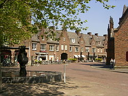
Wageningen (Dutch pronunciation: [ˈʋaːɣənɪŋə(n)]) is a municipality and a historic town in the central Netherlands, in the province of Gelderland. It is famous for Wageningen University, which specialises in life sciences. The municipality had a population of 37,434 in 2014, of which many thousands are students from over 150 countries.
Wageningen is situated on the north bank of the Nederrijn (the Dutch portion of the Lower Rhine) part of the Gelderse valley (Dutch: Gelderse Vallei) and the Veluwe, of which the southwest hill is called the Wageningse Berg. Wageningen can be reached by car from highways A12 via the N781, A15 via the N233 and N225, and A50 via the N225, and from the Ede-Wageningen railway station via a 15-minute bus drive to the Wageningen central terminal (see below).,
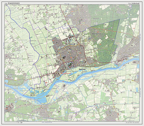
Topographic map of the municipality of Wageningen, July 2013 (click to enlarge)
The oldest known settlements in the Wageningen area were located north of today's town centre. They were mentioned as early as 828. During the early Middle Ages a small church was built on the hill east of the town. Several wood farms have been found near the top of the hill. In the twelfth century people settled at what is currently the Bergstraat. Close to Hotel de Wereld a stone floor has been found dating back to this period. After the construction of a dike to protect the city from the acidic water from the moors that then occupied the Gelderse Vallei (the current Hoogstraat), the oldest part of the present city was built to the south. The parts of the city north of the Hoogstraat were built later. Wageningen received city rights in 1263. The city was protected by a city wall and a moat, and in 1526 a castle was built. The castle was dismantled during the 18th century, but the foundations of three of the towers and part of the wall remain visible today.
...
Wikipedia


