WaKeeney, KS
| WaKeeney, Kansas | |
|---|---|
| City | |
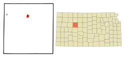
 Location within Trego County and Kansas |
|
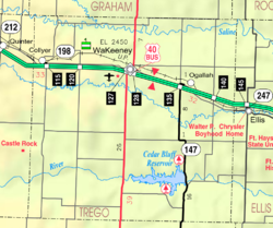
 KDOT map of Trego County (legend) |
|
| Coordinates: 39°1′28″N 99°52′55″W / 39.02444°N 99.88194°WCoordinates: 39°1′28″N 99°52′55″W / 39.02444°N 99.88194°W | |
| Country | United States |
| State | Kansas |
| County | Trego |
| Founded | 1879 |
| Incorporated | 1880 |
| Area | |
| • Total | 1.71 sq mi (4.43 km2) |
| • Land | 1.71 sq mi (4.43 km2) |
| • Water | 0 sq mi (0 km2) |
| Elevation | 2,447 ft (746 m) |
| Population (2010) | |
| • Total | 1,862 |
| • Estimate (2015) | 1,811 |
| • Density | 1,100/sq mi (420/km2) |
| Time zone | Central (CST) (UTC-6) |
| • Summer (DST) | CDT (UTC-5) |
| ZIP code | 67672 |
| Area code(s) | 785 |
| FIPS code | 20-74450 |
| GNIS feature ID | 0472517 |
| Website | Wakeeney.org |
WaKeeney is a city in and the county seat of Trego County, Kansas, United States. As of the 2010 census, the city population was 1,862.
James Keeney, a land speculator in Chicago, purchased land at the site of modern-day WaKeeney from the Kansas Pacific Railway in 1877. He and business partner Albert Warren formed Warren, Keeney, & Co., surveyed and plotted the site in 1878, and established a colony there in 1879. They named the colony WaKeeney, a portmanteau of their surnames, and billed it as "The Queen City of the High Plains", advertising and holding celebrations to attract settlers. The colony grew rapidly, but crop failures drove settlers to leave in 1880 as quickly as they had come. By 1882, all that was left were "five poorly patronized retail stores". Years later, Volga Germans began settling the area.
WaKeeney became the county seat in June 1879 and was incorporated as a city in 1880.
WaKeeney is located at 39°01′28″N 99°52′55″W / 39.024467°N 99.881972°W (39.024467, -99.881972) at an elevation of 2,447 feet (746 m). Located in northwestern Kansas at the intersection of Interstate 70 and U.S. Route 283, it is 162 miles (261 km) northwest of Wichita, 281 miles (452 km) east-southeast of Denver, and 284 miles (457 km) west of Kansas City.
...
Wikipedia
