Vranov nad Topľou
| Vranov nad Topľou | ||
| Town | ||
|
||
| Country | Slovakia | |
|---|---|---|
| Region | Prešov | |
| District | Vranov nad Topľou | |
| Elevation | 132 m (433 ft) | |
| Coordinates | 48°52′51″N 21°40′24″E / 48.88083°N 21.67333°ECoordinates: 48°52′51″N 21°40′24″E / 48.88083°N 21.67333°E | |
| Area | 31.10 km2 (12.0 sq mi) | |
| Population | 23,157 (31 December 2012) | |
| Density | 745/km2 (1,930/sq mi) | |
| Mayor | Ján Ragan | |
| Timezone | CET (UTC+1) | |
| - summer (DST) | CEST (UTC+2) | |
| Postal code | 093 01 | |
| Area code | +421-57 | |
| Car plate | VT | |
| Statistics: MOŠ/MIS | ||
| Website: www.vranov.sk | ||
Vranov nad Topľou (Slovak before 1927 and from 1944–1969: Vranov; German: Frö(h)nel / Vronau an der Töpl (rare); Hungarian: Varannó; Rusyn: Воронів над Топлёв) is a city of approximately 23,157 inhabitants in eastern Slovakia, situated near Košice and Prešov, and between the Topľa River and the Ondava River.
Parts: Vranov nad Topľou (proper); Čemerné
The name is derived from a Slovak word vrana (crow) with a possessive suffix -ov. In Latin medieval record, the settlement is often called Varanno (the Hungarized form), but also Wrano, Varanow or rarely Varanovia (the Latinized form).
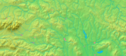
Vranov nad Toplou occupies the northwest bulge of the Eastern Slovak Lowland (Východoslovenská nížina) in the upper part of the region called Zemplín between the rivers Topľa and Ondava.
The earliest evidences of the human presence in the area of today's Vranov dates back to Paleolithic Era. Several artefacts from the Roman-Migration Period were unearth in the center of town. Extensive Slavic settlement (7th-10th century) existed in Lomnica (nowadays a part of Vranov), Slavic settlements are known also from Čemerné and other localities.
The first written mention about Vranov dates back to 1332-1337, but mentions about localities that are nowadays parts of town are older (1229, 1270, 1282). The medieval settlement of Vranov nad Topľou was part of the castle estate Čičva (Csisva) which was built in 1310. Because of the advantageous geographical position of the town situated on the important trading path leading from Eperjes/Prešov, Vranov nad Topľou became an economic and social centre for the territory in the basin of two rivers, the Ondava and the Topľa. Besides the local trade, handicraft production has been developed here, too.
...
Wikipedia


