Vlissingen
|
Vlissingen Flushing |
|||
|---|---|---|---|
| Municipality | |||

Clockwise from top left: Coastline skyscraper, harbour, museum, residential tower and boulevard with beach
|
|||
|
|||
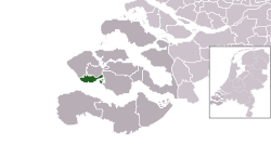
 Location in Zeeland |
|||
| Coordinates: 51°27′N 3°34′E / 51.450°N 3.567°ECoordinates: 51°27′N 3°34′E / 51.450°N 3.567°E | |||
| Country | Netherlands | ||
| Province | Zeeland | ||
| Boroughs |
8 Districts
|
||
| Government | |||
| • Body | Municipal council | ||
| • Mayor | Letty Demmers-van der Geest (D66) | ||
| Area | |||
| • Total | 344.83 km2 (133.14 sq mi) | ||
| • Land | 34.18 km2 (13.20 sq mi) | ||
| • Water | 310.65 km2 (119.94 sq mi) | ||
| Elevation | 1 m (3 ft) | ||
| Population (May 2014) | |||
| • Total | 44,353 | ||
| • Density | 1,298/km2 (3,360/sq mi) | ||
| Demonym(s) | Vlissinger | ||
| Time zone | CET (UTC+1) | ||
| • Summer (DST) | CEST (UTC+2) | ||
| Postcode | 4380–4389 | ||
| Area code | 0118 | ||
| Website | www |
||
Vlissingen (Dutch pronunciation: [ˈvlɪsɪŋə(n)]; Zeelandic: Vlissienge; historical name in English: Flushing) is a municipality and a city in the southwestern Netherlands on the former island of Walcheren. With its strategic location between the Scheldt river and the North Sea, Vlissingen has been an important harbour for centuries. It was granted city rights in 1315. In the 17th century Vlissingen was a main harbour for ships of the Dutch East India Company (VOC). It is also known as the birthplace of Admiral Michiel de Ruyter.
Vlissingen is mainly noted for the yards on the Scheldt where most of the ships of the Royal Netherlands Navy (Koninklijke Marine) are built.
The municipality of Vlissingen consists of the following places:
The fishermen’s hamlet that came into existence at the estuary of the Schelde around AD 620 has grown over its 1,400-year history into the third-most important port of the Netherlands. The Counts of Holland, Flanders, and Zeeland had the first harbours dug. Over the centuries, Vlissingen developed into a hub for fishing, especially the herring fishery, commerce, privateering and the slave trade. Under the Treaty of Nonsuch, English garrisons were stationed here and at Brill to keep these ports out of Spanish hands. During the heyday of the Dutch Golden Age, ships from Vlissingen set sail for the various outposts of the Dutch colonial empire and contributed to the world power of The Seven Provinces.
...
Wikipedia


