Vista, New York
| Lewisboro, New York | |
|---|---|
| Town | |
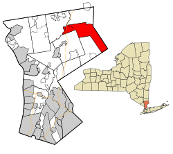
 Location of Lewisboro, New York |
|
| Coordinates: 41°16′1″N 73°35′19″W / 41.26694°N 73.58861°W | |
| Country | United States |
| State | New York |
| County | Westchester |
| Government | |
| • Town Supervisor | Peter Parsons (D) |
| Area | |
| • Total | 29.16 sq mi (75.53 km2) |
| • Land | 27.75 sq mi (71.86 km2) |
| • Water | 1.42 sq mi (3.67 km2) |
| Elevation | 440 ft (134 m) |
| Population (2010) | |
| • Total | 12,411 |
| • Estimate (2016) | 12,766 |
| • Density | 460.10/sq mi (177.65/km2) |
| Time zone | Eastern (EST) (UTC-5) |
| • Summer (DST) | EDT (UTC-4) |
| ZIP code | 10590, 10536, 10526, 10597, 10518 |
| Area code(s) | 914 |
| FIPS code | 36-42136 |
| GNIS feature ID | 0979145 |
| Website | Town Website |
Lewisboro is a town in Westchester County, New York, United States. The population was 12,411 at the 2010 census. The town is named after John Lewis, an early settler.
After purchasing land from the local natives, the first settlers established themselves around South Salem. The town was formed as "Salem" in 1747. By 1790 the town assumed its current dimensions as lands were removed for other towns. The name changed to South Salem in 1806. John Lewis, a financier, requested that the town be given his name and established a fund for the town, though he did not follow through on his promise of a railroad link. Lewisboro is noted for its elaborate gardens, most notable in its public traffic triangles. Dry-stone walls and elegant Colonial mansions are other dominant features.
Lewisboro has had two noteworthy historical characters. Sarah Bishop was the hermit of West Mountain. Apparently mistreated by British soldiers at the time of the Revolutionary War, she retreated to a solitary life in the Lewisboro area. A spot known as "Sarah Bishop's Cave" is on the hill on the north side of Lake Rippowam, near Mountain Lakes Camp. The second historical character appeared around the time of the Civil War. The Leatherman was a wanderer who got his name from homemade leather garments. He is frequently mentioned as being in Lewisboro in the middle of the 19th century. He followed a route past homes that would offer him a meal and reappeared at the same doorsteps for 25 years. One of the hiking destinations in Ward Pound Ridge is to the Leatherman's cave, reportedly one of his more frequent homes. In 1987 a 10k trail race called "The Leatherman's Loop" was started to honor his legacy and continues every spring at the Ward Pound Ridge Reservation.
The Mead Memorial Chapel was listed on the National Register of Historic Places in 1999.
The east town line is the border of Ridgefield, Connecticut. Interstate 684 passes near the west side of the town. The town's unusual chevron shape is partly the result of The Oblong, created during the resolution of the boundary dispute between Connecticut and New York.
...
Wikipedia
