Villejuif
| Villejuif | ||
|---|---|---|
|
||
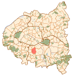
 Paris and inner ring departments |
||
| Coordinates: 48°47′31″N 2°21′49″E / 48.7919°N 2.3636°ECoordinates: 48°47′31″N 2°21′49″E / 48.7919°N 2.3636°E | ||
| Country | France | |
| Region | Île-de-France | |
| Department | Val-de-Marne | |
| Arrondissement | L'Haÿ-les-Roses | |
| Canton | Villejuif-Est (Chef-lieu) Villejuif-Ouest (Chef-lieu) |
|
| Intercommunality | Val de Bièvre | |
| Government | ||
| • Mayor | Franck Le Bohellec | |
| Area1 | 5.34 km2 (2.06 sq mi) | |
| Population (2008)2 | 53,240 | |
| • Density | 10,000/km2 (26,000/sq mi) | |
| Time zone | CET (UTC+1) | |
| • Summer (DST) | CEST (UTC+2) | |
| INSEE/Postal code | 94076 / 94800 | |
| Elevation | 62–130 m (203–427 ft) | |
| Website | [1] | |
|
1 French Land Register data, which excludes lakes, ponds, glaciers > 1 km² (0.386 sq mi or 247 acres) and river estuaries. 2Population without double counting: residents of multiple communes (e.g., students and military personnel) only counted once. |
||
1 French Land Register data, which excludes lakes, ponds, glaciers > 1 km² (0.386 sq mi or 247 acres) and river estuaries.
Villejuif (pronounced: [vilʒɥif]) is a commune in the southern suburbs of Paris, France. It is located 7 km (4.3 mi) from the centre of Paris.
The name Villejuif can be imprecisely translated as "Jewish Town", but the area has no historical connections with the Jewish population of Paris. The name is believed to be a corruption of a Gallo-Roman name, Villa Iuvii, meaning the villa of Iuvius.
Villejuif is served by three stations on Paris Métro Line 7: Villejuif – Léo Lagrange, Villejuif – Paul Vaillant-Couturier, and Villejuif – Louis Aragon.
Villejuif has many hospitals on its territory :
13 preschools, 11 elementary schools, and five junior high schools (Collège Aimé-Césaire, Collège Guy-Môquet, Collège Jean Lurçat, Collège Karl-Marx, Collège Pasteur) are in Villejuif. Lycée intercommunal Darius-Milhaud (in Le Kremlin-Bicêtre) serves Villejuif.
Other institutions:
...
Wikipedia

