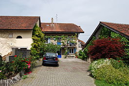
Villars-sous-Champvent
| Villars-sous-Champvent | ||
|---|---|---|
| Former municipality of Switzerland | ||
 |
||
|
||
| Coordinates: 46°47′N 6°35′E / 46.783°N 6.583°ECoordinates: 46°47′N 6°35′E / 46.783°N 6.583°E | ||
| Country | Switzerland | |
| Canton | Vaud | |
| District | Jura-Nord Vaudois | |
| Area | ||
| • Total | 0.92 km2 (0.36 sq mi) | |
| Elevation | 464 m (1,522 ft) | |
| Population (2010) | ||
| • Total | 59 | |
| • Density | 64/km2 (170/sq mi) | |
| Postal code | 1443 | |
| SFOS number | 5936 | |
| Surrounded by | Chamblon, Champvent, Essert-sous-Champvent, Montagny-près-Yverdon, Suscévaz | |
| Website | Profile (French), SFSO statistics |
|
Villars-sous-Champvent was a former municipality in the district of Jura-Nord Vaudois of the canton of Vaud in Switzerland. The municipalities of Essert-sous-Champvent and Villars-sous-Champvent merged on 1 January 2012 into the municipality of Champvent.
Villars-sous-Champvent had an area, as of 2009[update], of 0.9 square kilometers (0.35 sq mi). Of this area, 0.77 km2 (0.30 sq mi) or 84.6% is used for agricultural purposes, while 0.08 km2 (0.031 sq mi) or 8.8% is forested. Of the rest of the land, 0.06 km2 (15 acres) or 6.6% is settled (buildings or roads).
Of the built up area, housing and buildings made up 2.2% and transportation infrastructure made up 3.3%. Power and water infrastructure as well as other special developed areas made up 1.1% of the area Out of the forested land, 7.7% of the total land area is heavily forested and 1.1% is covered with orchards or small clusters of trees. Of the agricultural land, 70.3% is used for growing crops and 9.9% is pastures, while 4.4% is used for orchards or vine crops.
The former municipality was part of the Yverdon District until it was dissolved on 31 August 2006, and Villars-sous-Champvent became part of the new district of Jura-Nord Vaudois.
Villars-sous-Champvent lies at an elevation of 464 m (1,522 ft), 4.5 km (2.8 mi) west as the crow flies from Yverdon-les-Bains. This farm village is nestled in the Bey valley.
To the north are the hills that rise to the foot of the Jura Mountains. To the south lies the Mont de Chamblon (510 m (1,670 ft)), the highest point in the municipality.
The surrounding municipalities are Montagny-près-Yverdon, Chamblon, Suscévaz, Champvent, and Essert-sous-Champvent.
...
Wikipedia


