Villarrubia de los Ojos
| Villarrubia de los Ojos | ||
|---|---|---|
| Municipality | ||

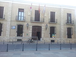
City hall
|
||
|
||
| Location in Spain | ||
| Coordinates: 39°13′N 3°36′W / 39.217°N 3.600°WCoordinates: 39°13′N 3°36′W / 39.217°N 3.600°W | ||
| Country |
|
|
| Autonomous community |
|
|
| Province | Ciudad Real | |
| Comarca | Campo de Calatrava | |
| Area | ||
| • Total | 281.86 km2 (108.83 sq mi) | |
| Elevation | 624 m (2,047 ft) | |
| Population (2010) | ||
| • Total | 11,119 | |
| • Density | 39/km2 (100/sq mi) | |
| Demonym(s) | Villarrubiero, Villarrubiera | |
| Time zone | CET (UTC+1) | |
| • Summer (DST) | CEST (UTC+2) | |
| Postal code | 13670 | |
Villarrubia de los Ojos is a municipality in Ciudad Real, Castile-La Mancha, Spain. According to the 2010 census the municipality has a population of 11,119 inhabitants.
The Ojos del Guadiana are located within the Villarrubia de los Ojos municipal term. They are the source of the Guadiana river, the fourth longest river of the Iberian peninsula. There's also a National Park, the Tablas de Daimiel National Park located in the Tablas de Daimiel wetlands, shared with the neighbouring municipality, Daimiel.
The landforms of Villarrubia de los Ojos are mountaineus in the north and flat in the south. The weather is quite strong with very cold winters and very hot summers. There are some mountains over 1.200 metres and the flat zone is at 550 metres above sea level in the Spanish central plateau.
...
Wikipedia


