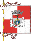
Vila do Porto
| Vila do Porto | |||
| Municipality (Concelho) | |||
|
From Pico Alto, the view of the main settlement of the island of Santa Maria, the community of Vila do Porto
|
|||
|
|||
| Official name: Concelho da Vila do Porto | |||
| Name origin: Portuguese for village of the port | |||
| Country | |||
|---|---|---|---|
| Autonomous Region | |||
| Island | Santa Maria | ||
| Municipality | Vila do Porto | ||
| Civil Parishes | Almagreira, Santa Bárbara, Santo Espírito, São Pedro, Vila do Porto | ||
| Center | Bom Despacho Velho | ||
| - elevation | 242 m (794 ft) | ||
| - coordinates | 36°58′19″N 25°5′54″W / 36.97194°N 25.09833°WCoordinates: 36°58′19″N 25°5′54″W / 36.97194°N 25.09833°W | ||
| Highest point | Pico Alto | ||
| - elevation | 586.64 m (1,925 ft) | ||
| - coordinates | 36°58′58″N 25°5′27″W / 36.98278°N 25.09083°W | ||
| Lowest point | Sea level | ||
| - location | Atlantic Ocean | ||
| - elevation | 0 m (0 ft) | ||
| Area | 96.89 km2 (37 sq mi) | ||
| - urban | 3.72 km2 (1 sq mi) | ||
| Population | 5,552 (2011) | ||
| Density | 57/km2 (148/sq mi) | ||
| Settlement | c. 1460 | ||
| LAU | Câmara Municipal | ||
| - location | Largo Nossa Senhora da Conceição | ||
| - elevation | 89 m (292 ft) | ||
| - coordinates | 36°57′11″N 25°8′36″W / 36.95306°N 25.14333°W | ||
| President | Nélia Maria Coutinho Figueiredo | ||
| Municipal Chair | António José Tavares de Loura | ||
| Timezone | Azores (UTC-1) | ||
| - summer (DST) | Azores (UTC0) | ||
| Postal Zone | 9580-539 | ||
| Area Code & Prefix | (+351) 292 XX XX XX | ||
| Patron Saint | Nossa Senhora da Assunção | ||
| Municipal Holidays | 15 August | ||
|
Location of the municipality of Vila do Porto in the archipelago of the Azores
|
|||
| Website: http://www.cm-viladoporto.pt | |||
Vila do Porto (Portuguese pronunciation: [ˈvilɐ ðu ˈpoɾtu], the Port Town) is the single municipality, the name of the main town and one of the civil parishes on the island of Santa Maria, in the Portuguese archipelago of Azores. Its nearest neighbor, administratively, is the municipality of Povoação on the southern coast of São Miguel (to the northwest), and it is physically southwest of the islets of the Formigas. The population in 2011 was 5,552, in an area of 96.89 km².
Santa Maria was the first island in the archipelago to be discovered by Diogo Silves in 1427. By 2 July 1439, a royal charter from Infante D. Pedro, regent of D. Afonso V, referred to the fact that Prince Henry the Navigator had ordered that sheep be set ashore along the seven islands of the Azores (since Corvo and Flores had, at the time, not been discovered). São Miguel and Santa Maria were the first islands to be settled by families from Estremadura, Alto Alentejo and Algarve, facilitated by Gonçalo Velho, then first donatary-captain of the Azores. Gonçalo Velho Cabral, nobleman in the House of the Infante D. Henrique (Henry the Navigator) and commander in the Order of Christ, arrived on the island of Santa Maria in 1432. In the cartography of the 14th Century, the island was referred to as Ilha dos Lobos (Island of Wolves, referring to the wolf seals that lived in the region at the time). It became the seat of the first Captaincy of the Azores, which initially included both Santa Maria and São Miguel.
Its first settlement originated in 1439, with the occupation of Praia dos Lobos (and eventually became the northern coastal village of Anjos). Around 1450, was the probably foundation of the settlement of Porto, by Fernão de Quental. Quental's colony was established along the south coast along an escarpment overlooking a small bay that afforded protection for ships: what would become known as the Vila do Porto (town of the port). This town would become incorporated in 1470, when the town of Porto received the obligatory and first foral (charter), in addition to the establishment of the first lighthouse in the Azores. Although never experiencing earthquakes since its initial settlement (in comparison to the other islands in the Azores), the community was always marked by isolation, inaccessibility and weak defensive position.
...
Wikipedia


