Vestvågøy
| Vestvågøy kommune | |||
|---|---|---|---|
| Municipality | |||
 |
|||
|
|||
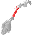
 Vestvågøy within Nordland |
|||
| Coordinates: 68°13′17″N 13°47′4″E / 68.22139°N 13.78444°ECoordinates: 68°13′17″N 13°47′4″E / 68.22139°N 13.78444°E | |||
| Country | Norway | ||
| County | Nordland | ||
| District | Lofoten | ||
| Administrative centre | Leknes | ||
| Government | |||
| • Mayor (2007) | Jonny Finstad (H) | ||
| Area | |||
| • Total | 423.36 km2 (163.46 sq mi) | ||
| • Land | 405.58 km2 (156.60 sq mi) | ||
| • Water | 17.78 km2 (6.86 sq mi) | ||
| Area rank | 233 in Norway | ||
| Population (2012) | |||
| • Total | 10,848 | ||
| • Rank | 338 in Norway | ||
| • Density | 26.7/km2 (69/sq mi) | ||
| • Change (10 years) | 1.7 % | ||
| Demonym(s) | Vestvågøyværing | ||
| Time zone | CET (UTC+1) | ||
| • Summer (DST) | CEST (UTC+2) | ||
| ISO 3166 code | NO-1860 | ||
| Official language form | Neutral | ||
| Website | www |
||
|
|
|||
Vestvågøy is a municipality in Nordland county, Norway. It is part of the traditional district of Lofoten. The administrative centre of the municipality is the town of Leknes. Some of the villages in the municipality include Ballstad, Borg, Bøstad, Gravdal, Knutstad, Stamsund, Tangstad, and Valberg. With over 10,800 inhabitants, Vestvågøy is the most populous municipality in all of the Lofoten and Vesterålen regions in Nordland county.
The Lofotr museum in Borg, Vestvågøy shows a reconstructed Iron Age Viking chieftain's residence, with a house measuring 80 metres (262 ft), built of stone and turf.
The municipality of Vestvågøy was created on 1 January 1963 when the old municipalities of Borge, Buksnes, Hol, and Valberg were all merged. Initially, it had 12,288 residents. The borders have not changed since.
The municipality is named after the island of Vestvågøya. The Old Norse name of the island was Lófót (see Lofoten) - but when Lofoten became the name of the whole archipelago, the old name was replaced with Vestvågøy. Vestvågøy can be broken down into three parts: vest-våg-øy which can be roughly translated as west-bay-island.
...
Wikipedia


