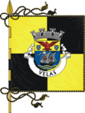
Velas
| Velas | |||
| Municipality (Concelho) | |||
|
Northern coast of Velas, showing Fajã de Fernando Afonso, as seen from the Park of Sete Fontes
|
|||
|
|||
| Official name: Concelho das Velas | |||
| Name origin: Portuguese for sails | |||
| Country | |||
|---|---|---|---|
| Autonomous Region | |||
| Island | São Jorge | ||
| Civil Parishes | Manadas, Norte Grande, Rosais, Santo Amaro, Urzelina, Velas | ||
| Center | Velas | ||
| - elevation | 40 m (131 ft) | ||
| - coordinates | 38°40′55″N 28°12′33″W / 38.68194°N 28.20917°WCoordinates: 38°40′55″N 28°12′33″W / 38.68194°N 28.20917°W | ||
| Highest point | Pico de Esperança | ||
| - elevation | 1,053 m (3,455 ft) | ||
| - coordinates | 38°40′9″N 28°7′19″W / 38.66917°N 28.12194°W | ||
| Lowest point | Sea level | ||
| - location | Atlantic Ocean | ||
| - elevation | 0 m (0 ft) | ||
| Area | 117.38 km2 (45 sq mi) | ||
| - water | .02 km2 (0 sq mi) | ||
| - urban | 3.8 km2 (1 sq mi) | ||
| Population | 5,398 (2011) | ||
| Density | 301.73/km2 (781/sq mi) | ||
| Settlement | c. 1460 | ||
| - Municipality | c. 1500 | ||
| LAU | Câmara Municipal | ||
| - location | Rua de São João | ||
| - elevation | 27 m (89 ft) | ||
| - coordinates | 38°40′52″N 28°12′23″W / 38.68111°N 28.20639°W | ||
| President | Manuel Soares Silveira (PS) | ||
| Municipal Chair | António Frederico Correia Maciel (PS) | ||
| Timezone | Azores (UTC-1) | ||
| - summer (DST) | Azores (UTC0) | ||
| Postal Zone | 9800-539 | ||
| Area Code & Prefix | (+351) 292 XXX-XXXX | ||
| Demonym | Velense | ||
| Patron Saint | São Jorge | ||
| Municipal Holidays | 23 April | ||
|
Location of the municipality of Velas in the archipelago of the Azores
|
|||
| Website: http://cm-velas.azoresdigital.pt | |||
Velas (Portuguese pronunciation: [ˈvɛlɐʃ]) is a municipality in the São Jorge Island, in the Portuguese autonomous region of Azores. The municipality encompasses the western portion of the island, with its municipal seat in the town of Velas on the south coast, and is divided into six parishes. The population in 2011 was 5,398, in an area of 117.38 km².
The origin of the name Velas has never been clarified by historians, although it may refer to the number of sailing ships that congregated in the municipality ("velas" is Portuguese for sails), but may also refer to the "sails" of the windmills that populated the municipality during early settlement. There may also been confusing in the similarity between velas, the word velhas (which means "old" in Portuguese) or "belas" (which means "beautiful", in the same language). Another reference is to the Portuguese term "vilar", which means vigilant, and may have been used to situation in the Canal, where residents were ever-vigilant for volcanic eruptions and/or seismic events.
The village of Velas is one of the oldest settled communities on the island, and has been traced back to the testimony of Infante D. Henrique, who referred to the 1460 when the community congregated around their church to the evocation of São Jorge. Its administrative status was elaborated in 1500, when it became the municipal authority and main village in the western part of the island (Topo being the first municipality). It was in 1507 that Velas could be identified on a map of the island of São Jorge as village. Similarly, the localities of Santo António (Norte Grande), and in 1559 Manadas were first recognized as a major settlements in the municipality; both centers would become religious parishes in 1543 and 1568 respectively. It was also in 1568, that Rosais would be recognized as a parish.
On the evening of April 28, 1580 (and during the following day), the ground would begin a series of about 80 earthquakes, that would cease abruptly. Nevertheless, on May 1 the tremors would return, followed by a volcanic explosion in the area of Queimada and later in the heights of Ribeira do Nabo, two kilometers east of the initial explosion. Volcanic lava was emitted along the Ribeira do Almeida and in Santo Amaro, and there was record of a pyroclastic flow that was responsible for the deaths of at least 10 people. This volcanic eruption lasted four months, and was responsible for many lava flows that travelled to the sea, and ash that fell as far as Terceira. During those months, 4000 cattle died due to gases and the lack of grazing lands, owing to the ash. Eight-years later, several floods would be responsible for the damage to many homes, while in 1593 agricultural production would fall, caused by a bad harvest.
...
Wikipedia


