Vechigen
| Vechigen | ||
|---|---|---|
 |
||
|
||
| Coordinates: 46°57′N 7°34′E / 46.950°N 7.567°ECoordinates: 46°57′N 7°34′E / 46.950°N 7.567°E | ||
| Country | Switzerland | |
| Canton | Bern | |
| District | Bern-Mittelland | |
| Government | ||
| • Mayor | Lorenz Hess | |
| Area | ||
| • Total | 24.83 km2 (9.59 sq mi) | |
| Elevation | 583 m (1,913 ft) | |
| Population (Dec 2015) | ||
| • Total | 5,252 | |
| • Density | 210/km2 (550/sq mi) | |
| Postal code | 3067 | |
| SFOS number | 0359 | |
| Surrounded by | Bolligen, Hasle bei Burgdorf, Krauchthal, Muri bei Bern, Oberburg, Stettlen, Walkringen, Worb | |
| Website |
www SFSO statistics |
|
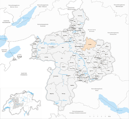
Vechigen is a municipality in the Bern-Mittelland administrative district in the canton of Bern in Switzerland. Until the administrative centralization of 1966 it was made up of four semi-autonomous communities; Vechigen, Sinneringen with Boll and Dentenberg, Utzigen with Lindental and Berg with Littewil and Radelfingen.
Vechigen is first mentioned in 1275 as Vechingen. Sinneringen was first mentioned in 1261-63 as Sineringen. Utzigen was called Uzingen in 1275.
The Vechigen valley and mountain originally belonged to the Baron of Belp-Montenach. However, in 1298, they lost their land to the growing city of Bern. From then on, Vechigen was one of the four outer parishes of Bern and until 1798 residents of the village were also citizens of the city.
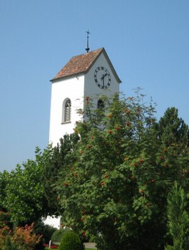
The village church of St. Martin was first mentioned in 1275. It was rebuilt in 1513/14, the bell tower dates from 1486.
In 1834 the municipality of Vechigen was formed with four quarters. The quarters were Vechigen, Sinneringen with Boll and Dentenberg, Utzigen with Lindental and Berg with Littewil and Radelfingen. Each quarter was responsible for local administration including schooling and road construction, while the municipality handled taxation and finance. In 1913 the Worblentalbahn opened a rail station in Boll-Utzigen. By 1950, the agglomeration of Bern had spread out along this line and the villages of Boll and Sinneringen became part of agglomeration area. The population grew rapidly in these two villages while it dropped or stagnated in the rest of the municipality. As the quarters changed from agricultural into residential, the decentralized government became inefficient and in 1966 it was centralized into a single government. In 1961 a secondary school was built in the municipality and there are now a total of five school buildings.
Until 1966, the Sinneringen quarter included Sinneringen, the hamlets Boll and Dentenberg as well as farm houses in the Worblen valley and on the Dentenberg mountain. On the hillside above the Worblen, several Hallstatt graves were discovered. A Roman villa was found on at Hubel. During the 13th century, the Counts of Kyburg were the vogts over the village. In 1729, Hans Rudolf von Diesbach built his country estate, the Schlössli, in Sinneringen. In 1844, the artist August von Bonstetten expanded the manor house and added a clock tower.
...
Wikipedia


