Van Vorst Park
|
Van Vorst Park Historic District
(Boundary Increase) |
|
 |
|
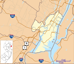
| Location | Roughly bounded by Mercer, Wayne, Montgomery , Grove, Bright, Varick and Monmouth Streets, Jersey City, New Jersey |
|---|---|
| Coordinates | 40°43′7″N 74°2′53″W / 40.71861°N 74.04806°W |
| Area | 77 acres (31 ha) |
| Architectural style | Late 19th And 20th Century Revivals |
| NRHP Reference # | 84000084 |
| NJRHP # | 1540 |
| Significant dates | |
| Added to NRHP | October 11, 1984 |
| Designated NJRHP | August 2, 1978 |
Van Vorst Park is an upper middle income neighborhood in the Historic Downtown of Jersey City, Hudson County, New Jersey, United States, centered on a park sharing the same name. The neighborhood is located west of Paulus Hook and Marin Boulevard, north of Grand Street, east of the Turnpike Extension, and south of The Village and Christopher Columbus Drive. Much of it is included in the Van Vorst Park Historical District.
The park was a centerpiece of Van Vorst Township, a township that existed in Hudson County from 1841 to 1851. Van Vorst was incorporated as a township by an Act of the New Jersey Legislature on April 12, 1841, from portions of Bergen Township. On March 18, 1851, Van Vorst Township was annexed by Jersey City.
The name Van Vorst comes from a prominent family in the area, the first of which arrived in the 1630s as superindentent of the patroonship Pavonia, the earliest European settlement on the west bank of the Hudson River in the province of New Netherland. His homestead at Harsimus, plus others at Communipaw, Paulus Hook, Minakwa, Pamrapo were later incorporated into Bergen. His namesake and eighth generation descendant, Cornelius Van Vorst, was the twelfth Mayor of Jersey City serving from 1860 to 1862.
...
Wikipedia


