Harsimus
|
Harsimus Cove Historic District
|
|

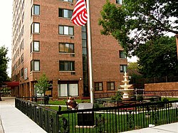
Fountain and Park on Second and Grove Street.
|
|
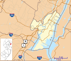
| Location | Roughly bounded by Grove .,Bay & First Sts., Jersey Avenue, Second, & Coles Sts., Jersey City, New Jersey |
|---|---|
| Coordinates | 40°43′24″N 74°2′41″W / 40.72333°N 74.04472°W |
| Area | 60 acres (24 ha) |
| Architect | Multiple |
| Architectural style | Late 19th And 20th Greek Revival, Late Victorian, Beaux Arts |
| NRHP Reference # | 87002118 |
| NJRHP # | 1509 |
| Significant dates | |
| Added to NRHP | December 9, 1987 |
| Designated NJRHP | October 15, 1987 |
Harsimus (also known as Harsimus Cove) is a neighborhood within Downtown Jersey City, Hudson County, New Jersey, United States. The neighborhood stretches from the Harsimus Stem Embankment (the Sixth Street Embankment) on the north to Christopher Columbus Drive on the south between Coles Street and Grove Street or more broadly, to Marin Boulevard. It borders the neighborhoods of Hamilton Park to the north, Van Vorst Park to the south, the Village to the west, and the Powerhouse Arts District to the east. Newark Avenue has traditionally been its main street. The name is from the Lenape, used by the Hackensack Indians who inhabited the region and could be translated as Crow’s Marsh. From many years, the neighborhood was part of the “Horseshoe”, a political delineation created by its position between the converging rail lines and political gerrymandering.
Harsimus is a derivative of a Lenape phrase, possibly meaning Crow's Marsh. Spellings include: Aharsimus,Ahasimus,Hasymes,Haassemus, Hahassemes, Hasimus, Horseemes, Hasseme,Horsimus In current Lenape, ahas means "crow".
In 1629, the Dutchman Michael Reyniersz Pauw obtained a patent for all the land in what would become Hudson County, naming it Pavonia. Unable to fulfill a patroon charter provision that he set up a plantation with fifty permanent settlers, the Dutch West India Company sold a part to his superintendent, who had built a homestead in 1634 and was the first of many Van Vorsts to play important roles in the development of the city. A family homestead built in 1647 was demolished in 1967. Conflict with Native Americans compromised the settlement 1643, which continued to grow after the 1645 treaty ending Kieft's War. Again in 1655, the area was attacked in a conflict called the Peach Tree War. In 1660, it came under the jurisdiction of Bergen, New Netherland the main village of which was located at Bergen Square.
...
Wikipedia


