Van Cortlandt Village, Bronx
| Van Cortlandt Village | |
|---|---|
| Neighborhood of the Bronx | |
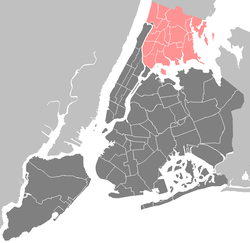
| Location in New York City | |
| Coordinates: 40°53′02″N 73°53′39″W / 40.88375°N 73.894139°WCoordinates: 40°53′02″N 73°53′39″W / 40.88375°N 73.894139°W | |
| Country |
|
| State |
|
| City | New York City |
| Borough | Bronx |
| Area | |
| • Total | 2.23 km2 (0.862 sq mi) |
| Population (2010) | |
| • Total | 50,100 |
| • Density | 22,000/km2 (58,000/sq mi) |
| Economics | |
| • Median income | $49,126 |
| Ethnicity | |
| • Hispanic and Latino Americans | 64.5% |
| • African-American | 17.0% |
| • White | 12.1% |
| • Asian | 4.8% |
| • Others | 1.7% |
| ZIP codes | 10463 |
| Area code | 718, 347, 646 |
Van Cortlandt Village is a subsection of the Kingsbridge Heights section of the New York City borough of the Bronx. The neighborhood is part of Bronx Community Board 8. Named after Van Cortlandt Park, it is bordered by the Major Deegan Expressway to the west, the Jerome Park Reservoir to the east, West 238th Street to the south, and Van Cortlandt Park to the north. Its ZIP code is 10463.
Van Cortlandt Village has traditionally been classified as part of Kingsbridge Heights. The 0.5 square miles (1.3 km2) neighborhood is generally thought to extend from its namesake Van Cortlandt Park on the north, to Dickinson and Sedgwick Avenues on the east, to Bailey Avenue on the west and Albany Crescent on the south.
On September 28, 2004, the New York City Department of City Planning approved the rezoning all or portions of 15 blocks in this northwestern Bronx neighborhood (bounded by Van Cortlandt Park South to the north, Fort Independence Park and Sedgwick Avenue to the east, West 231st Street and Albany Crescent to the south, and by Heath Avenue, Fort Independence Street and Orloff Avenue to the west) into Van Cortlandt Village, which is located within Community District 8.The zoning changes aimed to preserve the community's low-rise/low-density character by ensuring that new development is compatible in scale, both with the one- and two-family detached homes that prevail in parts of the neighborhood and with the more diverse housing stock in others. The area is predominantly low-density residential, with a significant number of one- and two-family detached and semi-detached houses. Even the multifamily apartment buildings in the area are seldom taller than 70 feet (21 m).
Its housing stock is diverse, including spacious single-family homes, multiple-family attached homes and postwar co-op buildings. The New York Times describes the area as a "serene enclave of quaint homes, winding streets and abundant trees." The area is described by Anthony Perez Cassino, a former chairman of Bronx Community Board 8 who helped to rezone the neighborhood, as a "vulnerable" area, owing to the fact that it is more affordable than nearby Riverdale. A garland of greenery wends through the neighborhood. In the heart of the area, on twisting hilly streets like Giles Place and Cannon Place, are elegant brick homes with porticos and manicured hedges. Along the broader avenues are handsome co-op buildings, capped on the northern end by the Amalgamated Cooperative Houses, one of the city's historically significant co-op complexes. With nearly 1,500 units in 11 buildings, the complex was founded in 1927 by leaders of the Amalgamated Clothing Workers Union, who fashioned it as a sort of proletarian paradise. While some of the descendants of the mostly Jewish immigrants who made up the Amalgamated's original tenants remain, a more diverse collection of residents carry on its legacy, with communal enterprises like children's play groups and art classes.
...
Wikipedia


