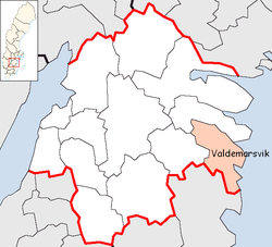
Valdemarsvik Municipality
|
Valdemarsvik Municipality Valdemarsviks kommun |
||
|---|---|---|
| Municipality | ||
|
||
 |
||
| Country | Sweden | |
| County | Östergötland County | |
| Seat | Valdemarsvik | |
| Area | ||
| • Total | 2,049.56 km2 (791.34 sq mi) | |
| • Land | 733.82 km2 (283.33 sq mi) | |
| • Water | 1,315.74 km2 (508.01 sq mi) | |
| Area as of January 1, 2014. | ||
| Population (December 31, 2016) | ||
| • Total | 7,809 | |
| • Density | 3.8/km2 (9.9/sq mi) | |
| Time zone | CET (UTC+1) | |
| • Summer (DST) | CEST (UTC+2) | |
| ISO 3166 code | SE | |
| Province | Östergötland and Småland | |
| Municipal code | 0563 | |
| Website | www.valdemarsvik.se | |
Valdemarsvik Municipality (Valdemarsviks kommun) is a municipality in Östergötland County in southeast Sweden. Its seat is located in the town of Valdemarsvik.
Valdemarsvik was originally a market town (köping) under the city of Söderköping. When the first local government acts came into force in Sweden in 1863 Valdemarsvik was not made a municipality of its own, but part of Ringarum. It was detached from Ringarum in 1914. The municipal reform of 1971 created the present municipality by reuniting Ringarum with Valdemarsvik and also adding Gryt and a part of the dissolved Tjust-Ed. The latter territory was transferred from Kalmar County.
Geographically, it is notable for an archipelago and a harbour.
The local church is from the 1870s, with extensive renovations in the early 20th century.
Coordinates: 58°12′N 16°36′E / 58.200°N 16.600°E
...
Wikipedia

