Vaals
| Vaals | |||
|---|---|---|---|
| Municipality | |||

View of Vaals
|
|||
|
|||
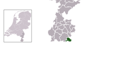
 Location in Limburg |
|||
| Coordinates: 50°46′N 6°1′E / 50.767°N 6.017°ECoordinates: 50°46′N 6°1′E / 50.767°N 6.017°E | |||
| Country | Netherlands | ||
| Province | Limburg | ||
| Government | |||
| • Body | Municipal council | ||
| • Mayor | Reg van Loo (independent) | ||
| Area | |||
| • Total | 23.87 km2 (9.22 sq mi) | ||
| • Land | 23.86 km2 (9.21 sq mi) | ||
| • Water | 0.01 km2 (0.004 sq mi) | ||
| Elevation | 200 m (700 ft) | ||
| Highest elevation | 322.7 m (1,058.7 ft) | ||
| Population (May 2014) | |||
| • Total | 9,691 | ||
| • Density | 406/km2 (1,050/sq mi) | ||
| Demonym(s) | Vaalzer | ||
| Time zone | CET (UTC+1) | ||
| • Summer (DST) | CEST (UTC+2) | ||
| Postcode | 6290–6295 | ||
| Area code | 043 | ||
| Website | www |
||
Vaals (![]() pronunciation ) is a town in the extreme southeastern part of the Dutch province of Limburg, which in its turn finds itself in the southeastern part of the Netherlands.
pronunciation ) is a town in the extreme southeastern part of the Dutch province of Limburg, which in its turn finds itself in the southeastern part of the Netherlands.
The municipality covers an area of 23.87 km2 (9.22 sq mi) in the foothills of the Ardennes–Eifelrange and is located about 23 km (14 mi) east of Maastricht and 5 km (3.1 mi) west of the city centre of Aachen.
It borders on both Belgium and Germany. The three borders meet on the Drielandenpunt, a few meters from the highest point in the European part of the Netherlands, the Vaalserberg. The Vaalserberg used to be called "Hubertusberg".
In the municipality of Vaals, there are four villages and nine townships. Due to Vaals being located near the German border, the population of German people represents 26% of the total population of Vaals.
Number of inhabitants per 1/1/2005:
Next to these official villages and towns, the Vaals municipality also hosts a number of townships:
Camerig, Cottessen, Harles, Mamelis, Melleschet, Raren, Rott, Wolfhaag
...
Wikipedia


