Upper Tyrone Township, Pennsylvania
| Upper Tyrone Township | |
|---|---|
| Township | |

Municipal Building
|
|
 Location of Upper Tyrone Township in Fayette County |
|
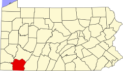
 Location of Fayette County in Pennsylvania |
|
| Country | United States |
| State | Pennsylvania |
| County | Fayette |
| Area | |
| • Total | 7.82 sq mi (20.25 km2) |
| • Land | 7.80 sq mi (20.20 km2) |
| • Water | 0.02 sq mi (0.06 km2) |
| Population (2010) | |
| • Total | 2,059 |
| • Density | 264/sq mi (101.9/km2) |
| Time zone | EST (UTC-4) |
| • Summer (DST) | EDT (UTC-5) |
| Area code(s) | 724 |
| Website | uppertyronetwp |
Upper Tyrone Township is a township in Fayette County, Pennsylvania, United States. The population was 2,059 at the 2010 census. It is served by the Southmoreland School District.
Communities in the township include Keifertown, King View, Owensdale, McClure, Dry Hill, Walnut Hill, and part of Prittstown.
It is named after County Tyrone, Northern Ireland.
The township is on the northern edge of Fayette County, bordered to the north by Westmoreland County. Jacobs Creek forms the northern border of the township and the county line. The borough of Everson, a separate municipality, lies along the south side of Jacobs Creek next to the township.
According to the United States Census Bureau, the township has a total area of 7.82 square miles (20.25 km2), of which 7.80 square miles (20.20 km2) is land and 0.02 square miles (0.06 km2), or 0.27%, is water.
As of the census of 2000, there were 2,244 people, 870 households, and 664 families residing in the township. The population density was 288.4 people per square mile (111.4/km²). There were 902 housing units at an average density of 115.9/sq mi (44.8/km²). The racial makeup of the township was 98.62% White, 0.80% African American, 0.04% Native American, 0.04% Asian, 0.04% Pacific Islander, and 0.45% from two or more races. Hispanic or Latino of any race were 0.49% of the population.
...
Wikipedia
