Upper Montclair, NJ
| Upper Montclair, New Jersey | |
|---|---|
| Census-designated place | |

Upper Montclair business district
|
|
| Nickname(s): Up-town | |
 Location in Essex County and the state of New Jersey. |
|
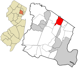
| Location of Upper Montclair in Essex County. Inset: Location of Essex County in New Jersey. | |
| Coordinates: 40°50′33″N 74°12′05″W / 40.842576°N 74.201302°WCoordinates: 40°50′33″N 74°12′05″W / 40.842576°N 74.201302°W | |
| Country |
|
| State |
|
| County | Essex |
| Township | Montclair |
| Area | |
| • Total | 2.536 sq mi (6.569 km2) |
| • Land | 2.535 sq mi (6.567 km2) |
| • Water | 0.001 sq mi (0.002 km2) 0.04% |
| Elevation | 322 ft (98 m) |
| Population (2010 Census) | |
| • Total | 11,565 |
| • Density | 1,699.9/sq mi (656.3/km2) |
| Time zone | Eastern (EST) (UTC-5) |
| • Summer (DST) | EDT (UTC-4) |
| ZIP codes | 07043 |
| Area code(s) | 862/973 |
| FIPS code | 3475020 |
| GNIS feature ID | 2584034 |
| Website | http://www.montclairnjusa.org/ |
Upper Montclair is a census-designated place (CDP), unincorporated community and neighborhood within Montclair in Essex County, New Jersey, United States. As of the 2010 United States Census, the population for the CDP was 11,565. The area is served as United States Postal Service ZIP code 07043. It is often misperceived, even by Montclair residents, to be a separate municipality from Montclair, perhaps aided by this postal designation.
The area now known as Upper Montclair was first developed in the early 18th century as a rural community known as Speertown, named for John Speer, an early Dutch settler. The area remained a rural hamlet for much of that century. The modern township of Montclair, including Upper Montclair, was incorporated in 1868 from part of Bloomfield Township.
According to the United States Census Bureau, the CDP had a total area of 2.536 square miles (6.569 km2), including 2.535 square miles (6.567 km2) of land and 0.001 square miles (0.002 km2) of water (0.04%).
Upper Montclair is north of Watchung Avenue, covering 40.2% of Montclair township's area.
As of the 2010 United States Census, there were 11,565 people, 4,178 households, and 3,146 families residing in the CDP. The population density was 4,561.4 per square mile (1,761.2/km2). There were 4,310 housing units at an average density of 1,699.9 per square mile (656.3/km2). The racial makeup of the CDP was 83.99% (9,713) White, 6.46% (747) Black or African American, 0.10% (12) Native American, 4.18% (483) Asian, 0.00% (0) Pacific Islander, 1.31% (151) from other races, and 3.97% (459) from two or more races. Hispanic or Latino of any race were 5.61% (649) of the population.
...
Wikipedia

