Upland, California
| Upland, California | |||
|---|---|---|---|
| City | |||
| City of Upland | |||

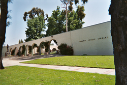
Upland City Hall (left) and Upland Public Library (right)
|
|||
|
|||
| Nickname(s): The City of Gracious Living | |||
 Location in San Bernardino County in the state of California |
|||
| Location in the United States | |||
| Coordinates: 34°6′N 117°39′W / 34.100°N 117.650°W | |||
| Country |
|
||
| State |
|
||
| County | San Bernardino | ||
| Incorporated | May 15, 1906 | ||
| Government | |||
| • Mayor | Ray Musser | ||
| Area | |||
| • Total | 15.651 sq mi (40.535 km2) | ||
| • Land | 15.617 sq mi (40.448 km2) | ||
| • Water | 0.034 sq mi (0.087 km2) 0.21% | ||
| Elevation | 1,237 ft (377 m) | ||
| Population (April 1, 2010) | |||
| • Total | 73,732 | ||
| • Estimate (2013) | 75,413 | ||
| • Density | 4,700/sq mi (1,800/km2) | ||
| Time zone | Pacific Time Zone (UTC-8) | ||
| • Summer (DST) | PDT (UTC-7) | ||
| ZIP codes | 91784–91786 | ||
| Area code | 909 | ||
| FIPS code | 06-81344 | ||
| GNIS feature IDs | 1661606, 2412137 | ||
| Website | www |
||
Upland is a city in San Bernardino County, California, in the United States. The municipality is located at an elevation of 1,242 feet (379 m). As of the 2010 census, the city had a population of 73,732, up from 68,393 at the 2000 census. It was incorporated on May 15, 1906, after previously being named North Ontario. Upland is located at the foot of the highest part of the San Gabriel Mountains. The city is part of the Inland Empire, a metropolitan area situated directly east of the Los Angeles metropolitan area.
Upland originally was an irrigation colony established by George and William Chaffey. When founded, it was a small rural town based on agriculture, specifically citrus fruits and grapes.
A trolley line in the broad, tree-lined median of Euclid Avenue formerly connected Upland to the Southern Pacific Railroad line in Ontario. The trolley was pulled from Ontario to Upland by a mule, which then climbed aboard an attached trailer for the ride back down.
Present-day Upland maintains many of the same features, most specifically Euclid Avenue (the north-south, tree-lined street that runs through town) as well as many of the older, adobe and ranch-style houses.
Upland is located at the foot of the San Gabriel Mountains on an east-west trail that was used by the Indians and Spanish missionaries, part of what is now known as the Old Spanish Trail. To the west, the trail led to the San Gabriel Mission, which Spanish Missionaries built in 1771.
In 1774, Spanish explorer Juan Bautista de Anza established an overland route from Arizona to California, with part of the trail passing through present day Upland on the way to the San Gabriel Mission. Anza's route went through Yuma, the San Gorgonio Pass and through the San Bemardino Valley. In 1775, Anza led a second expedition consisting of more than 240 people on a journey of over two thousand miles to the San Francisco Bay. En route, the expedition reached the San Gabriel Mission on January 4, 1776. The expedition reached the San Francisco Bay on June 27, 1776, where Anza founded the present day city of San Francisco. Five years later, in 1781, Spanish settlers followed Anza's route to found the city of Los Angeles a few miles west of the San Gabriel Mission.
...
Wikipedia


