Underhill, Vermont
| Underhill, Vermont | |
|---|---|
| Town | |
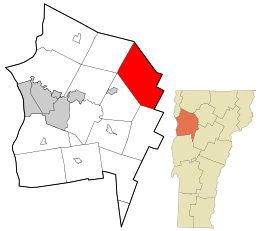
 Location in Chittenden County and the state of Vermont. |
|
| Location in the United States | |
| Coordinates: 44°32′9″N 72°55′26″W / 44.53583°N 72.92389°WCoordinates: 44°32′9″N 72°55′26″W / 44.53583°N 72.92389°W | |
| Country | United States |
| State | Vermont |
| County | Chittenden |
| Area | |
| • Total | 51.4 sq mi (133.1 km2) |
| • Land | 51.4 sq mi (133.0 km2) |
| • Water | 0.0 sq mi (0.1 km2) |
| Elevation | 1,033 ft (315 m) |
| Population (2014) | |
| • Total | 3,067 |
| • Density | 58.7/sq mi (22.4/km2) |
| Time zone | Eastern (EST) (UTC−5) |
| • Summer (DST) | EDT (UTC−4) |
| ZIP code | 05489–05490 |
| Area code | 802 |
| FIPS code | 50-73975 |
| GNIS feature ID | 1462232 |
Underhill is a town in Chittenden County, Vermont, United States. The population was 3,016 at the 2010 census.
The town of Underhill shares a fire department with Jericho, the Underhill-Jericho Fire Department.
According to the United States Census Bureau, the town has a total area of 51.4 mi2 (133.1 km2), of which 51.3 mi2 (133.0 km2) is land and 0.1 mi2 (0.1 km2) (0.10%) is water.
Underhill is home to the highest summit within the State, Mount Mansfield, which has a peak elevation of 4,393 feet (1,339 m) above sea level.
The Browns River is the primary waterway within the town and originates as a stream from Mt. Mansfield. It runs southwest and converges in the valley, just east of the village of Underhill Center with two other streams that also originate from the Mt. Mansfield; first with the Stevensville Brook, and then with Clay Brook about 0.5 miles (0.80 km) further. Harvey Brook, Cranes Brook, and Mill Brook draining from other hillsides within the town also converge with the Browns River in Underhill Center.
The Town of Underhill contains two villages; Underhill Flats and Underhill Center. Both villages have U.S. post office buildings and are enumerated with ZIP codes 05489 (Underhill Flats) and 05490 (Underhill Center).
Underhill Flats is located on the western side of the town along the Vermont Route 15 corridor, and is a shared jurisdiction with the adjacent town of Jericho, Vermont. This area is otherwise known as the Underhill Incorporated District (i.e. Underhill ID) and straddles the Riverside Settlement in Jericho as well as the Flatts Settlement in Underhill. The Incorporated District was a unique authorization created by the Vermont legislature. It was listed as a designated historic Village Center; the Riverside Village Center by the former Department of Housing and Community Affairs (now known as the Agency of Commerce and Community Development) in 2010. The United Church of Underhill Presbyterian Church, and the Underhill-Jericho main fire station are located on the Underhill side of the district. The majority of the district's geographic area lies within the Town of Jericho.
...
Wikipedia

