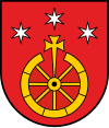
Tyrawa Wołoska
| Tyrawa Woloska | ||
|---|---|---|
|
||
| Coordinates: 49°35′N 22°22′E / 49.583°N 22.367°E | ||
| Country | Poland | |
| Region | Subcarpathian Voivodship | |
| Founded | 1402 | |
| Area | ||
| • Total | 68.8 km2 (26.6 sq mi) | |
| Elevation | 340 m (1,120 ft) | |
| Population | ||
| • Total | 1,950 | |
Coordinates: 49°35′N 22°22′E / 49.583°N 22.367°E
Tyrawa Wołoska [tɨˈrava vɔˈwɔska] (Ukrainian: Тирява Волоська, Tyriava Volos’ka; Latin: Tyravia minori, Thyrawa Walaska). A village in East Małopolska in the Lesser Beskid mountains of Poland.
The community is about 40 miles from Rzeszów, in south-eastern Poland. It is situated below the main watershed, at the foot of the Słonne Mountain, and has an elevation of 340 metres. It lies in a wooded, hilly area on the Nr. DK28 highway that goes from Przemyśl to Sanok. It belongs to the Subcarpathian Voivodship (since 1999), previously the Krosno Voivodship (1975-1998) and is part of the Sanok County (10 miles east of Sanok); its parish: Tyrawa Woloska.
Settled in prehistoric times, the south-eastern Poland region that is now Podkarpacie was overrun in pre-Roman times by various tribes, including the Celts, Goths and Vandals (the Przeworsk and Puchov cultures). After the fall of the Roman Empire, of which most of south-eastern Poland was part of (all territories below the San), the area was invaded by Hungarians and Slavs.
...
Wikipedia


