Tuticorin District
|
Thoothukudi district தூத்துக்குடி மாவட்டம் |
|
|---|---|
| District | |

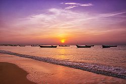
Sunrise at Thoothukudi beach
|
|
 Location in Tamil Nadu, India |
|
| Coordinates: 8°48′10.8″N 78°8′40.2″E / 8.803000°N 78.144500°ECoordinates: 8°48′10.8″N 78°8′40.2″E / 8.803000°N 78.144500°E | |
| Country |
|
| State | Tamil Nadu |
| Municipal Corporations | Thoothukudi |
| Headquarters | Thoothukudi |
| Talukas | Ettayapuram, Kovilpatti, Ottapidaram, Sathankulam, Srivaikundam, Thoothukudi, Tiruchendur, Vilathikulam. |
| Government | |
| • Collector | M. Ravikumar IAS |
| Area | |
| • Total | 4,745 km2 (1,832 sq mi) |
| Area rank | 10 |
| Population (2011) | |
| • Total | 1,750,176 |
| • Rank | 20 |
| • Density | 369/km2 (960/sq mi) |
| Languages | |
| • Official | Tamil |
| Time zone | IST (UTC+5:30) |
| PIN | 628xxx |
| Telephone code | 0461 |
| ISO 3166 code | [[ISO 3166-2:IN|]] |
| Vehicle registration | TN-69,TN-92 |
| Central location: | 8°48′N 78°8′E / 8.800°N 78.133°E |
| Website | thoothukudi |
Thoothukudi District, also known as Tuticorin District is a district in Tamil Nadu state in southern India. The district was formed by dividing Tirunelveli district in 1986 and Thoothukudi is the district headquarters. The district is known for pearl cultivation, with an abundance of pearls being found in the seas offshore. It was formerly ruled by one of the oldest kingdoms in India, the Pandyan Dynasty with the port of Korkai through which trade with Rome happened. The archaeological site at Adichanallur holds the remains of the ancient Tamil civilisation. As of 2011, the district had a population of 1,750,176 with a sex-ratio of 1,023 females for every 1,000 males.
Thoothukudi district is situated in the south-eastern corner of Tamil Nadu. It is bounded on the north by the districts of Tirunelveli, Virudhunagar, and Ramanathapuram, on the east and southeast by the Gulf of Mannar and on the west and southwest by Tirunelveli district. The total area of the district is 4621 km². The district of Thoothukudi was carved out as a separate district on 20 October 1986 as a result of bifurcation of the Tirunelveli district.
There are no large reservoirs in this district so the Papanasam and Manimuthar dams located in the Tirunelveli district in the Thamirabarani River's flow are the main sources of irrigation. Other than the Thamirabarani River, the river Vaipar in Vilathikulam taluk, the river Karumeni which traverses through Sathankulam, and Tiruchendur taluks, Palayakayal are all sources.
...
Wikipedia
