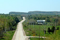
Turner, Ontario
| Northeastern Manitoulin and the Islands | |
|---|---|
| Town (single-tier) | |
| Town of Northeastern Manitoulin and the Islands | |
 |
|
| Coordinates: 45°58′N 81°56′W / 45.967°N 81.933°WCoordinates: 45°58′N 81°56′W / 45.967°N 81.933°W | |
| Country |
|
| Province |
|
| District | Manitoulin |
| Established | January 1, 1998 |
| Government | |
| • Type | Town |
| • Mayor | Alan MacNevin |
| • MP | Carol Hughes (NDP) |
| • MPP | Michael Mantha (NDP) |
| Area | |
| • Land | 495.68 km2 (191.38 sq mi) |
| Population (2011) | |
| • Total | 2,706 |
| • Density | 5.5/km2 (14/sq mi) |
| Time zone | EST (UTC-5) |
| • Summer (DST) | EDT (UTC-4) |
| Postal code | P0P 1K0 |
| Area code(s) | 705 |
| Website | www.townofnemi.on.ca |
Northeastern Manitoulin and the Islands is a municipality with town status in Manitoulin District in Northeastern Ontario, Canada, approximately 30 kilometres (19 mi) south of Espanola. Its main town is Little Current, located on the northeast side of Manitoulin Island. However, its territory also includes most of the small islands surrounding Manitoulin, even those at the far western end of Manitoulin.
The town was created on January 1, 1998, by amalgamating the Town of Little Current with the Township of Howland and the unorganized small islands in Lake Huron.
It is the administrative headquarters of the Aundeck Omni Kaning First Nations band government.
Little Current is the largest community within the town, as well as its administrative centre. Formerly an independent town, Little Current was named variously by different groups for the swift strong currents of water running between the narrow passageway which connects the North Channel and Georgian Bay. Past names for the community included Waebijewung, Le Petit Courant and Shaftsbury.
The town also includes the smaller communities of Cold Springs, Dinner Point Depot, Eads Bush, Green Bay, Honora, Rockville, and Sheguiandah.
In the late 19th century lake vessels stopped here to take on wood for fuel. A settlement developed, with George Abotossaway, an Anishinaabe man, selling fuel to the steamers. The westbound passengers on board the vessels were usually from Upper Canada. One group included the Turner family which disembarked and, being merchants, set up a general store still in business today.
The lumbering trade was foremost in the region at the time and saw mills were established at nearby Low Island, now a park in the community. Settlers cleared the land for farming.
Today the local economy continues to include farming and lumbering but tourism is a main aspect.
...
Wikipedia

