Tulare County, California
| Tulare County, California | ||||||
|---|---|---|---|---|---|---|
| County | ||||||
| County of Tulare | ||||||
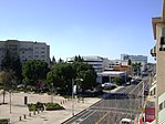
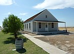
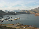
Images, from top down, left to right: Acequia Avenue in Visalia, Allensworth Hotel in Colonel Allensworth State Historic Park, Moro Rock in Sequoia National Park, Lake Kaweah
|
||||||
|
||||||
 Tulare County's location in California |
||||||
| Location in the United States | ||||||
| Coordinates: 36°14′N 118°48′W / 36.23°N 118.80°WCoordinates: 36°14′N 118°48′W / 36.23°N 118.80°W | ||||||
| Country |
|
|||||
| State |
|
|||||
| Regions | San Joaquin Valley and Sierra Nevada | |||||
| Metro area | Visalia-Porterville Metropolitan Area | |||||
| Incorporated | 1852 | |||||
| Named for | Tulare Lake | |||||
| County seat | Visalia | |||||
| Incorporated cities | 8 | |||||
| Government | ||||||
| • Administrative Officer | Michael Spata | |||||
| • Board of Supervisors |
Supervisors
|
|||||
| Area | ||||||
| • Total | 4,839 sq mi (12,530 km2) | |||||
| • Land | 4,824 sq mi (12,490 km2) | |||||
| • Water | 14 sq mi (40 km2) | |||||
| Highest elevation | 14,501 ft (4,420 m) | |||||
| Population (April 1, 2010) | ||||||
| • Total | 442,179 | |||||
| • Estimate (2015) | 459,863 | |||||
| • Density | 91/sq mi (35/km2) | |||||
| Time zone | Pacific (UTC-8) | |||||
| • Summer (DST) | PDT (UTC-7) | |||||
| Area code | 559 | |||||
| FIPS code | 06-107 | |||||
| GNIS feature ID | 277318 | |||||
| Website | www |
|||||
Tulare County (/tᵿˈlɛəri/ too-LAIR-ee) is a county in the U.S. state of California. As of the 2010 census, the population was 442,179. Its county seat is Visalia. The county is named for Tulare Lake, once the largest freshwater lake west of the Great Lakes. Drained for agricultural development, the site is now in Kings County, which was created in 1893 from the western portion of the formerly larger Tulare County.
Tulare County comprises the Visalia-Porterville, CA Metropolitan Statistical Area. The county is located south of Fresno, spanning from the San Joaquin Valley east to the Sierra Nevada.
Sequoia National Park is located in the county, as are part of Kings Canyon National Park, in its northeast corner (shared with Fresno County), and part of Mount Whitney, on its eastern border (shared with Inyo County). As of the 2010 census, the population was 442,179, up from 368,021 at the 2000 census.
...
Wikipedia


