Tuen Mun Stop
| MTR Light Rail stop | |||||||||||||||||||||

A train at Tuen Mun Stop
|
|||||||||||||||||||||
| Location |
Tuen Mun Tuen Mun District, Hong Kong |
||||||||||||||||||||
| Coordinates | 22°23′38″N 113°58′23″E / 22.3939°N 113.9730°ECoordinates: 22°23′38″N 113°58′23″E / 22.3939°N 113.9730°E | ||||||||||||||||||||
| Owned by | KCR Corporation | ||||||||||||||||||||
| Operated by | MTR Corporation | ||||||||||||||||||||
| Line(s) |
|
||||||||||||||||||||
| Platforms | 2 (2 side platforms) | ||||||||||||||||||||
| Tracks | 2 | ||||||||||||||||||||
| Connections | |||||||||||||||||||||
| Construction | |||||||||||||||||||||
| Structure type | Elevated | ||||||||||||||||||||
| Disabled access | Yes | ||||||||||||||||||||
| Other information | |||||||||||||||||||||
| Station code | 295 | ||||||||||||||||||||
| Fare zone | 2 | ||||||||||||||||||||
| History | |||||||||||||||||||||
| Opened |
|
||||||||||||||||||||
| Services | |||||||||||||||||||||
|
|||||||||||||||||||||
| Location | |||||||||||||||||||||
|
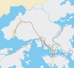
Location within the MTR system
|
|||||||||||||||||||||
Tuen Mun (Chinese: 屯門) is an MTR Light Rail stop which belongs to zone 2. There are two platforms in Tuen Mun Stop. This Light Rail stop is located above Pui To Road and Ho Pong Street and north of Tuen Mun Park. It provides service for nearby residents and is an interchange station for the West Rail Line.
On 23 September 1988, San Fat Stop opened below the site of the current Tuen Mun Stop, at ground level. It was named after the San Fat Estate. On 1 August 2003, San Fat Stop was renamed Tuen Mun Stop (in preparation for the opening of the West Rail Line Tuen Mun Station later that year). At that time, the at-grade platforms were still used. On 30 August the same year, the elevated platforms officially commenced service, although some Light Rail vehicles had been using the westbound platform from one week before.
...
Wikipedia

