Troy, Alabama
| Troy, Alabama | |
|---|---|
| City | |
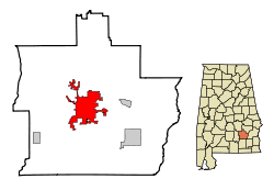
 Location within Pike County (left) and Alabama (right) |
|
| Coordinates: 31°48′32″N 85°58′12″W / 31.80889°N 85.97000°WCoordinates: 31°48′32″N 85°58′12″W / 31.80889°N 85.97000°W | |
| Country | United States |
| State | Alabama |
| County | Pike |
| Founded | 1838 |
| Incorporated | 1843 |
| Government | |
| • Type | Mayor-Council |
| • Mayor | Jason Reeves |
| Area | |
| • Total | 27.627 sq mi (71.55 km2) |
| • Land | 27.5 sq mi (71.3 km2) |
| • Water | 0.1 sq mi (0.2 km2) |
| Elevation | 541 ft (165 m) |
| Population (2010) | |
| • Total | 18,033 |
| • Estimate (2013) | 18,919 |
| • Density | 650/sq mi (250/km2) |
| Time zone | CST (UTC-6) |
| • Summer (DST) | CDT (UTC-5) |
| ZIP codes | 36079, 36081, 36082 |
| Area code | 334 Exchanges: 566,670,807,808 |
| FIPS code | 01-76920 |
| GNIS feature ID | 0153725 |
| Website | troyal.gov |
Troy is a city in Pike County, Alabama, United States. As of the 2010 census, the population was 18,033. Troy has experienced a growth spurt of over 4,000 people since 2000. The city is the county seat of Pike County. Troy is a college town and is home to Troy University. It formally incorporated on February 4, 1843.
Troy is located at 31°48′32″N 85°58′12″W / 31.80889°N 85.97000°W (31.808768, -85.969951). It is in the East Gulf Coastal Plains region of Alabama. It is located along the Troy Cuesta ridge, which runs across the state from east to west and is the boundary that separates the Chunnenuggee Hills and Southern Red Hills geographical boundaries. Elevations commonly reach 400 feet (120 m) in these hills and can reach up to 500 feet (150 m) in some areas. About 40 miles (64 km) north of Troy near the Montgomery area, the Chunnenuggee Hills region ends and the flat "Black Prairie" region begins, commonly known as the Black Belt region. About 60 miles (97 km) south of Troy in the Dothan area, the Southern Red Hills region ends and the "Dougherty Plains" region begins. Map
Much of the region consists of pine forests. Most tree species found in the area are pine, hickory, oak, pecan, and populus. The 231-mile (372 km) long Conecuh River flows at the northern end of Troy. A 45-acre (180,000 m2) lake called Pike County Lake is located at the southern end of Troy.
According to the U.S. Census Bureau, the city has a total area of 26.3 square miles (68 km2), of which 26.2 square miles (68 km2) is land and 0.1 square miles (0.26 km2) (0.34%) is water.
...
Wikipedia
