Trollhättan
| Trollhättan | |
|---|---|

The Göta älv river and Trollhättan Water Tower in central Trollhättan
|
|
| Coordinates: 58°17′N 12°17′E / 58.283°N 12.283°ECoordinates: 58°17′N 12°17′E / 58.283°N 12.283°E | |
| Country | Sweden |
| Province | Västergötland |
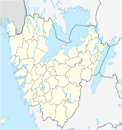
| County | Västra Götaland County |
| Municipality | Trollhättan Municipality |
| Area | |
| • Total | 23.78 km2 (9.18 sq mi) |
| Population (31 December 2010) | |
| • Total | 46,457 |
| • Density | 1,954/km2 (5,060/sq mi) |
| Time zone | CET (UTC+1) |
| • Summer (DST) | CEST (UTC+2) |
| Website | www |
Trollhättan (Swedish pronunciation: [trɔlˈhɛtːan]) is a city and the seat of Trollhättan Municipality, Västra Götaland County, Sweden, with 46,457 inhabitants in 2010. It is located 75 km north of Sweden's second-largest city, Gothenburg.
Trollhättan was founded on the river Göta älv, at the Trollhättan Falls. The site was first mentioned in literature from 1413. For centuries, Trollhättan was an obstacle for boats travelling the river, until a lock system was completed in the 19th century. It has since been updated several times, and the present locks were finished in 1916.
In the late 19th century, hydropower was developed in Trollhättan. The Swedish energy corporation Vattenfall ("waterfall") took its name from the falls in Trollhättan. Today the city has two operational hydropower stations, Olidan and Håjum. The hydropower has helped the city in its industrial revolution.
Trollhättan was granted city rights (which today have no legal effect) in 1916 at which time it had about 15,000 inhabitants, now grown to 54,000.
On 22 October 2015, a young man armed with a sword attacked pupils and staff at a school, killing 3 persons.
The name Trollhättan is translated as "troll's bonnet". The latter part "hätta" could also mean mountain top.
...
Wikipedia


