Toronto, Ohio
| Toronto, City (Ohio) | |
|---|---|

Toronto's World War I memorial
|
|
|
Motto: eobsd Faced |
|
 Location of Toronto, Ohio |
|
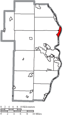
 Location of Toronto in Jefferson County |
|
| Coordinates: 40°27′44″N 80°36′16″W / 40.46222°N 80.60444°WCoordinates: 40°27′44″N 80°36′16″W / 40.46222°N 80.60444°W | |
| Country | United States |
| State | Ohio |
| County | Jefferson |
| Townships | Island Creek, Knox |
| Area | |
| • Total | 2.14 sq mi (5.54 km2) |
| • Land | 1.86 sq mi (4.82 km2) |
| • Water | 0.28 sq mi (0.73 km2) |
| Elevation | 702 ft (214 m) |
| Population (2010) | |
| • Total | 5,091 |
| • Estimate (2012) | 4,972 |
| • Density | 2,737.1/sq mi (1,056.8/km2) |
| Time zone | Eastern (EST) (UTC−5) |
| • Summer (DST) | EDT (UTC−4) |
| ZIP code | 43964 |
| Area code | 740 |
| FIPS code | 39-77112 |
| GNIS feature ID | 1061699 |
Motto: eobsd
Toronto is the second-largest city in Jefferson County, Ohio, United States, along the Ohio River. The population was 5,091 at the 2010 census. It is part of the Weirton-Steubenville, WV-OH Metropolitan Statistical Area.
The area was first settled in the 19th century, when it was known as Newburg's Landing. When the railway was built, however, the area's name was changed to Sloanes Station. In 1881, after a vote, the town was incorporated under its present name. This was taken from the much larger Canadian city of the same name, which civic leader Thomas M. Daniels felt was a place worth emulating.
In the 20th century, the town became a center of heavy industry with a number of large factories in and around the town. In the 1980s and 1990s the city, along with the rest of the region, declined sharply as manufacturing jobs left. Today TIMET, the world's largest supplier of titanium metals, is the major employer in the city.
Toronto is located at 40°27′44″N 80°36′16″W / 40.46222°N 80.60444°W (40.462266, -80.604443), and is about 45 minutes from Pittsburgh. According to the United States Census Bureau, the city has a total area of 2.14 square miles (5.54 km2), of which 1.86 square miles (4.82 km2) is land and 0.28 square miles (0.73 km2) is water.
As of the census of 2010, there were 5,091 people, 2,278 households, and 1,395 families residing in the city. The population density was 2,737.1 inhabitants per square mile (1,056.8/km2). There were 2,516 housing units at an average density of 1,352.7 per square mile (522.3/km2). The racial makeup of the city was 97.1% White, 1.1% African American, 0.2% Native American, 0.2% Asian, 0.1% from other races, and 1.3% from two or more races. Hispanic or Latino of any race were 0.8% of the population.
...
Wikipedia
