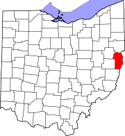
Jefferson County, Ohio
| Jefferson County, Ohio | ||
|---|---|---|

|
||
|
||
 Location in the U.S. state of Ohio |
||
 Ohio's location in the U.S. |
||
| Founded | July 29, 1797 | |
| Named for | Thomas Jefferson | |
| Seat | Steubenville | |
| Largest city | Steubenville | |
| Area | ||
| • Total | 411 sq mi (1,064 km2) | |
| • Land | 408 sq mi (1,057 km2) | |
| • Water | 2.6 sq mi (7 km2), 0.6% | |
| Population | ||
| • (2010) | 69,709 | |
| • Density | 171/sq mi (66/km²) | |
| Time zone | Eastern: UTC-5/-4 | |
| Website | www |
|
Jefferson County is a county located in the U.S. state of Ohio. As of the 2010 census, the population was 69,709. Its county seat is Steubenville. The county is named for Thomas Jefferson, who was at the time Vice President.
Jefferson County is part of the Weirton-Steubenville, WV-OH Metropolitan Statistical Area, which is also included in the Pittsburgh-New Castle-Weirton, PA-WV-OH Combined Statistical Area.
Jefferson County was organized on July 29, 1797 by proclamation of Governor Arthur St. Clair, six years before Ohio was granted statehood.
In 1786, the United States built Fort Steuben to protect the government surveyors mapping the land west of the Ohio River. When the surveyors completed their task a few years later, the fort was abandoned. In the meantime, settlers had built homes around the fort; they named their settlement La Belle. When the County was created in 1797, La Belle was selected as the County seat. The town was subsequently renamed Steubenville, in honor of the abandoned fort.
During the first half of the nineteenth century, Steubenville was primarily a port town, and the rest of the county consisted of small villages and farms. However, in 1856, Frazier, Kilgore and Company erected a rolling mill (the forerunner of steel mills) and the Steubenville Coal and Mining Company sank a coal shaft, resulting in Jefferson County becoming one of the leading centers of the new Industrial Revolution.
Jefferson County's population has declined to 70% of its 1960 figure as its manufacturing base collapsed over the last few decades.
According to the U.S. Census Bureau, the county has a total area of 411 square miles (1,060 km2), of which 408 square miles (1,060 km2) is land and 2.6 square miles (6.7 km2) (0.6%) is water.
As of the census of 2000, there were 73,894 people, 30,417 households, and 20,592 families residing in the county. The population density was 180 people per square mile (70/km²). There were 33,291 housing units at an average density of 81 per square mile (31/km²). The racial makeup of the county was 92.49% White, 5.68% Black or African American, 0.20% Native American, 0.33% Asian, 0.02% Pacific Islander, 0.25% from other races, and 1.03% from two or more races. 0.62% of the population were Hispanic or Latino of any race. 96.5% spoke English, 1.1% Spanish and 1.0% Italian as their first language.
...
Wikipedia

